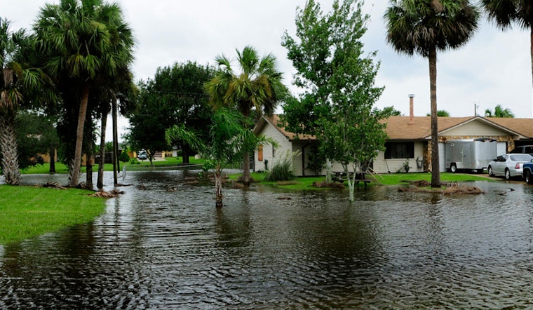
A surge of severe weather has prompted the National Weather Service to issue a flood watch and wind advisory for wide-reaching areas of Oregon and Washington. As reported early this morning, heavy rain and authoritative gusts of wind are anticipated across the region, bearing the potential for urban flooding and landslides.
Officials are cautioning residents to prepare for "river and urban flooding caused by excessive rainfall," which is expected to persist from now until late Thursday night. The NWS has projected that river levels could rise quickly and residents should be ready to "take action should flooding develop." In further detail, the forecast anticipates a prolonged atmospheric river event which will likely concentrate heavy rain primarily on northwest Oregon and southwest Washington until Wednesday, with lighter rain to follow from Thursday into Friday. These conditions have been set to suddenly increase the risk for flooding.
The flood watch details that forecast rain amounts from Monday through Thursday ranged from 4 to 12 inches in various parts of the region, which has extensively heightened risks for an array of flood-related hazards. Communities near the base of steep slopes, in narrow canyons, and at the mouths of canyons were flagged for being particularly vulnerable to the ravage of rapidly moving landslides.
Moreover, the wind advisory warns of southwest winds 15 to 25 mph with peak gusts up to 35 to 45 mph. These conditions are feared to likely exacerbate the impact of the already saturated soils, further increasing the chances for falling trees and potential power outages. The hardest-hit areas are expected to be west of the Willamette Valley and along the Coast Range, where the NWS urges residents to "use extra caution when driving," especially if operating a high profile vehicle.
In the midst of the deluge, the Flood Warning issued remains in effect for several rivers across Washington and Oregon. The Grays River, Wilson River, and Johnson Creek were all highlighted in the warning. Above 13.0 feet, expect flooding to begin at numerous locations along Johnson Creek, and in such event, evacuations have historically been prompted. As of this morning, the Johnson Creek was reported to be at a mere 2.9 feet but expected to rise sharply with the incoming rain.
As the region braces for impactful flooding and disquieting wind, officials encourage residents to heed the warnings, taking all necessary precautions. The NWS reminds the public to "Turn around, don`t drown when encountering flooded roads" and stresses the importance of not attempting to drive around barricades or drive through flooded areas. The latest updates and additional information are available on the NWS website.


