The city of Chicago braces itself for a brisk and snowy week. The National Weather Service reports "mostly sunny" skies today with highs hovering around 16 degrees, despite wind chill values that could drop as low as -12. Come evening, the temperature is expected to dip close to 1 degree with similar chilling winds.
Thursday's forecast remains sunny with a high near 14 degrees, though the wind chill might once again drop dangerously down to -10. As cited by the National Weather Service, urgency grows as nighttime approaches, with a 30 percent chance of snow after 3 a.m. This light dusting elegantly paves the way for what's to come: snow becomes "likely" by Friday, holding a 70 percent chance of precipitation.
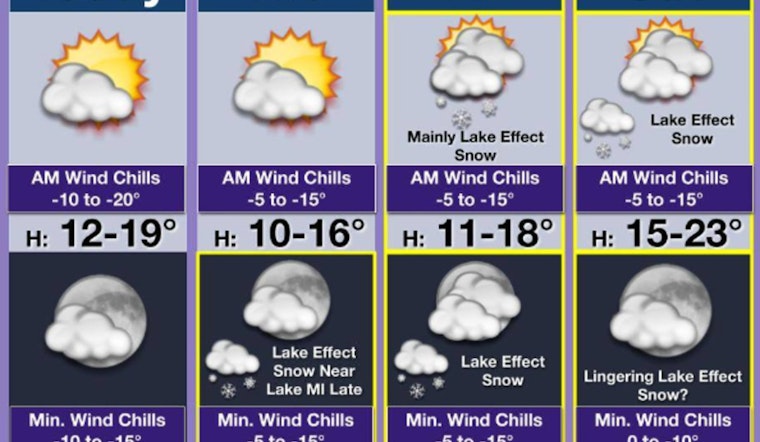
Switching over to the local spectrum, FOX 32 Chicago adds depth to this chilly narrative, warning residents of lake-effect snow that could blanket the city with up to 6 inches by the week's end. The report advises viewers to stay indoors during the early hours to avoid the extremely cold temperatures, which have been recorded as low as zero degrees with even more biting wind chills.
As Friday and Saturday approach, so does the unpredictability of the lake-effect snowfall. "It is still too early to pinpoint exactly how far inland that snow will go and for whom the deepest totals will be," notes FOX 32 Chicago. Yet, despite the potential for fluctuation, some areas might yet receive significant accumulation that could impact transit and day-to-day life. The weekend's temperatures are projected to coast in the "low to mid 20s."


