Residents in Cleveland are bracing for a significant chill as the National Weather Service (NWS) has issued an Extreme Cold Warning effective until 11 AM this morning. According to NWS experts, dangerous wind chills as low as -27 F are expected, bringing significant cold exposure risks to the entire area. The weather service has also issued a Cold Weather Advisory from 7 PM this evening to 11 AM Wednesday due to forecast confidence in wind chill values plunging below -15 F.
In addition to the severe cold, some light snow is forecasted across the region today, which may affect travel conditions. "Blowing snow west of I-71 and along the lakeshore" was highlighted by the NWS, which could to potentially reduce visibility for commuters this morning. Snow accumulations and blowing snow are added concerns that drivers will need to navigate.
Looking ahead, the forecast does not bring much relief in terms of temperatures. The region is advised to gear up for prolonged cold through the weekend. "Elevated risks for cold exposure and damage to infrastructure" were mentioned in the NWS forecast discussion, flagging down the potential for issues such as burst pipes and dead batteries because of the persisting cold. Daytime high temperatures are set to struggle to exceed 10 F, reminding everyone that winter is far from over.
Concerning travel for flyers, the aviation outlook points to additional periods of snow with non-VFR conditions anticipated through this Saturday. The challenges are primarily expected in NE Ohio and NW PA, including impacting areas such as Cleveland, Youngstown, and Erie airport vicinities with periodic lake-effect snow.
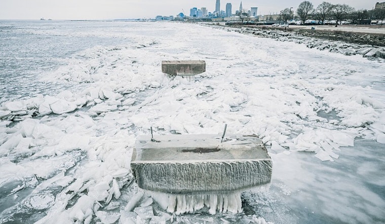
The maritime situation is similarly affected by the weather. Lake Erie, now "100% ice covered," will see winds that may lead to shifting ice fields, although the NWS forecasts that these will become "more anchored in place" as the ice thickens through the weekend. Sailors and those involved in lake activities should take note of fluctuating wind speeds and directions, even if most travel on the lake is currently halted.
Finally, the cold spell hitting Ohio could lead to new record low temperatures. The NWS cites historical records for the coming dates, underscoring just how intense this current freeze really is. Residents of Toledo, Mansfield, Cleveland, Akron, Youngstown, and Erie should all be aware of the possibilities, with all these cities facing potential historical lows.


.jpg)