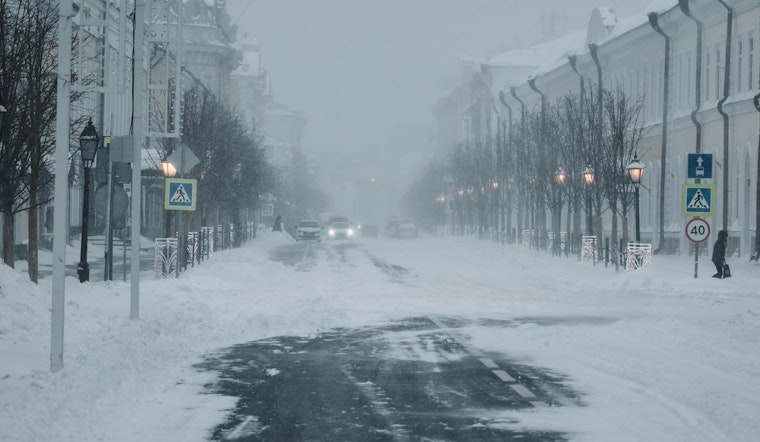
Residents across portions of south central and southwest Illinois and central, east central, and southeast Missouri woke up to an icy, blustering mix of heavy snow and biting cold that's forecasted to stick around for a bit. The National Weather Service in St. Louis is not pulling any punches with their advisories—issuing a Winter Storm Warning that remains in effect until 6 PM CST this evening. If you’re in the affected areas, prepare for "heavy snow" with total daytime accumulation of 3 to 5 inches possible, making for treacherous commutes and bone-chilling walks for folks out there clearing sidewalks.
The situation doesn’t get much better tonight. While most of the snow action is expected to cease before the evening, according to the Winter Storm Warning, the temperatures are set to plummet to around -3°F with wind chills dipping to a dangerous low of -15. Residents are warned of the hazardous conditions, noting that the "rapid accumulation of snow will make travel extremely difficult, if not impossible." The advice? If you must hit the road, carry an extra flashlight, along with food and water.
But hold on to your hats and gloves because the frosty saga doesn’t end there. As this arctic air mass settles in, an Extreme Cold Warning has been hoisted from "midnight tonight to noon CST Monday," with wind chills expected to hit 15 to 25 below zero. Frostbite can occur on exposed skin in as little as 30 minutes under these conditions. For those keeping score at home, actual temperatures might reach as low as 5 to 10 degrees below zero.
As we inch into the week, the bone-chilling grip of winter shows little sign of loosening. Monday predicts sunny and cold conditions with high near 16, but don't let the sun fool you—the wind chill values can plummet as low as -20. "Dress in layers including a hat, face mask, and gloves if you must go outside," according to the Extreme Cold Warning.


