Washington woke up to a slap of midwinter reality Tuesday, with temperatures plunged into the 20s and a real risk of black ice lurking on the morning commute. Any leftover moisture from Monday night refroze in the pre-dawn chill, turning even small strips of seemingly wet pavement on bridges, ramps and shaded sidewalks into potential slip zones. Later in the day, sunshine should break through and nudge afternoon highs into the upper 30s, offering a modest but welcome thaw.
Local TV forecasters were waving the caution flag early. According to WUSA9, temperatures will be in the 20s early Tuesday and there "will be a lot of black ice early Tuesday." The station warned that "if surfaces look wet late tonight and early Tuesday treat them as ice," a clear signal that the usual morning rush could be trickier than normal.
What the forecast shows
The National Weather Service point forecast for the District lays out a classic freeze-and-thaw setup: lows around 25°F early Tuesday, followed by a high near 39°F this afternoon. Late Tuesday night, forecasters say there is a chance of light snow that may mix with rain toward dawn. You can dig into the hourly breakdown from the National Weather Service, which will have the latest tweaks as the day and night unfold.
What to watch on the commute
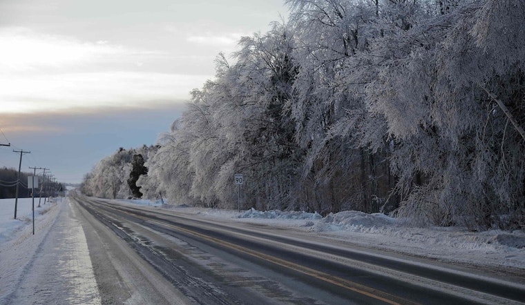
For anyone heading out early, the main headline is simple: icy patches are likely on untreated side streets, bridge decks and shaded sidewalks where the cold air has had easy access. Regional forecasters have been stressing the refreeze risk, and WBAL has advised drivers to "watch for some icy spots on Tuesday morning." The Capital Weather Gang notes that morning lows in the 20s "may mean some slick spots," which is meteorologist-speak for slow down and do not trust that glossy-looking pavement.
Practical translation: give yourself extra time, walk and drive more slowly than usual, and assume that anything that looks wet before mid-morning could actually be frozen.
Short-term outlook
The good news is that the chilly grip should loosen quickly. Forecasters expect a solid warm-up on Wednesday, with highs pushing into the 50s before another system moves in later in the week with more clouds and rain, according to the National Weather Service and local analysts. For Tuesday morning, though, the message stays straightforward: take it easy, especially on bridges and in the shade, and let the sun do some work before you hit the accelerator.


