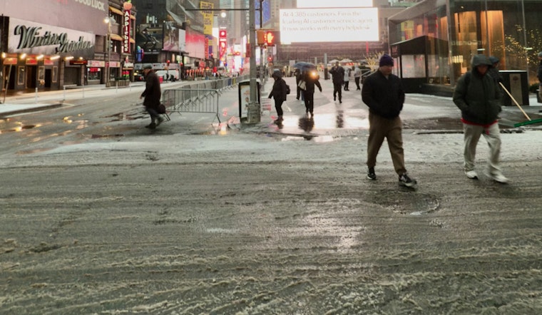
New Yorkers woke up to clear skies and a not-so-clear path to work, as near-freezing temperatures across parts of the five boroughs turned yesterday’s melt into fresh patches of black ice. Readings are hovering from the low 30s in shaded or inland spots to the upper 30s along warmer corridors, and the slickest trouble spots are the usual suspects: untreated sidewalks, ramps and other surfaces that never quite dried out. Drivers and pedestrians should plan on a slick start through the early hours.
Morning Commute: Black Ice Risk
A Special Weather Statement notes that rapid overnight cooling combined with leftover snowmelt has already produced areas of black ice, with particular concern for bridges, ramps and untreated side streets. Motorists are urged to slow down and leave extra stopping distance, and pedestrians are being advised to watch their step on unplowed or untreated sidewalks, according to NWS Upton.
Today: Slight Chance Of Light Snow
Through the afternoon, the forecast calls for a high near 39°F with partly sunny skies and a slight, roughly 20 percent, chance of light snow after 1 p.m. Any flakes that do fall should stay light and are not expected to produce measurable accumulation on already warmer surfaces. A north wind around 5 to 8 mph will keep things feeling chilly, and tonight temperatures drop to near 26°F, with wind chill values in the low 20s, a setup that leaves any remaining wet spots primed to refreeze after dark.
Getting Around
Travelers may want to pad their morning schedule and steer clear of secondary streets that might not have been fully treated. The city’s emergency office is also encouraging New Yorkers to sign up for NotifyNYC and to stick with standard winter safety habits, per NYC Emergency Management.
Weekend And Next Week
Looking ahead, sunshine returns Friday with highs near 40°F and a milder Saturday in the mid-40s. An arctic front arriving late Sunday is expected to drag in a colder air mass and scattered snow showers. By Sunday night into Monday, temperatures are forecast to tumble, with highs stuck in the 20s and another chance of light snow early next week as a couple of weak systems pass nearby. For now, any accumulation in the city still looks limited.
Related Coverage
We recently covered earlier refreeze and cleanup efforts on Tuesday, including background on street clearing and city response. For more on how black ice turned the morning commute treacherous, revisit that breakdown of plowing priorities and where crews have been concentrating their work.


