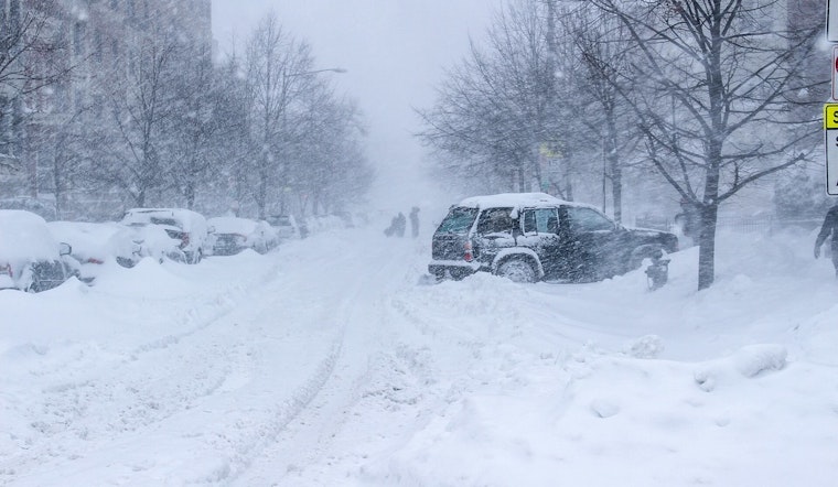
Philadelphia woke up Monday, February 23, 2026, to a full-on snow slog. Heavy, wet flakes, dense fog and near-zero visibility have turned the morning rush into a slow crawl or a non-starter for many. Temperatures are hovering near freezing, roughly 32°F, while strong northwest winds whip snow into drifts along side streets. City plows are concentrating on major arteries, but as fresh bands of heavy snow roll through, a lot of neighborhood blocks remain tough to reach.
Blizzard Warning Through Monday Evening
The National Weather Service has a Blizzard Warning in effect through 6 p.m. EST on Monday, February 23, 2026, calling for very heavy snowfall, whiteout conditions and wind gusts that may hit 45 mph, according to NWS Mount Holly. Forecasters are expecting snowfall rates of 1 to 3 inches per hour in the strongest bands, with total new accumulations of 10 to 14 inches possible across the Philadelphia metro and locally higher amounts where those bands park themselves. Significant drifting is also on the table. The NWS warns that travel could be "very difficult to impossible" and that the heavy, wet snow may down tree limbs and trigger scattered power outages.
What To Expect This Afternoon
The worst of the snow and visibility is expected through mid to late morning. After that, the storm should gradually back off to scattered flurries and patches of blowing snow by afternoon. Daytime highs are forecast to top out near 37°F, but northwest winds of 15 to 25 mph, with higher gusts, will keep roads slick and help pile snow back into drifts on untreated streets. Even once the steady snow shuts down, plow crews caution that blowing snow can quickly re-cover cleared pavement and drag out the evening commute.
City Response And Closures
The City of Philadelphia declared a Snow Emergency starting at 4 p.m. Sunday and has suspended nonessential services, closed municipal buildings and courts, and pushed trash and recycling pickup back two days, according to city officials. The School District shifted to virtual learning for Monday, while the Office of Homeless Services activated Code Blue and opened warming centers for people seeking shelter from the cold.
Residents are being urged to charge phones and other devices, check in on vulnerable neighbors and skip any nonessential travel so plow and emergency crews can focus on the main routes. The basic message from City Hall: if you can stay home, do.
Transit And Commute
Public transit is operating only as conditions allow, and riders are being told to check service alerts before heading out and to brace for delays or temporary route suspensions. If you absolutely have to travel, officials say to build in a lot of extra time, keep your gas tank reasonably full and stash an emergency kit in your vehicle. Sudden closures are possible as conditions change.
For drivers who get stuck, the guidance is to stay with your vehicle and call for help only in an actual emergency, both for your safety and to avoid tying up limited resources.
Legal Implications
Under the city's Snow Emergency rules, vehicles left on designated snow-emergency routes are now subject to ticketing and towing so plows can get through. Enforcement is already in effect, per the city's announcement. Moving cars off those routes and following posted restrictions not only speeds up street clearing, it also cuts your chances of ending the day with a fine or an unexpected tow bill.
We published our pre-storm guide yesterday with tips on preparedness and what to expect as the system moved in. This story will be updated as the situation evolves, so check back for changes to road conditions, transit service and shelter options throughout the day.


