Rain and patchy fog are sliding across Cincinnati Sunday morning, with temperatures stuck in the upper 30s and slick spots building on some roads. Lunken (KLUK) and other area stations are clocking light rain and mist, and visibility is dropping in river valleys and low‑lying neighborhoods. The steadier rain should back off later in the day as temperatures climb toward the low 50s.
Rain Through Midday
Look for the rain to hang on through late morning before shifting east of the city by mid to late afternoon. The high should land near 51°F with light east winds. Most neighborhoods can expect roughly a half to three‑quarters of an inch of new rainfall, which is enough to cause ponding in poor‑drainage spots and slower drives on the usual trouble stretches. This guidance comes from the National Weather Service Wilmington.
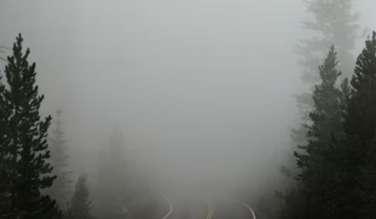
Dense Fog Late Tonight Into Monday Morning
Once the rain pulls out, any clearing skies will leave behind plenty of low‑level moisture and light winds, a recipe for widespread fog after about 2 a.m. Some of that fog could turn dense overnight, with visibility dropping to a quarter mile or less in the worst patches. That sets up a Monday morning commute that could be slow and occasionally hazardous, so plan extra time and stick with low beams. Early flights and other visibility‑sensitive operations may also see delays until the fog lifts.
Midweek Warmup And Gusts
Temperatures then swing sharply upward next week, with highs expected to reach the mid‑60s to near 67°F by Wednesday and a legitimate shot at record readings in parts of the region. The warmth will not arrive quietly: a chance of showers on Wednesday and a tightening pressure gradient could bring wind gusts topping 30 mph by midweek. Another round of rain is likely Thursday night, along with a slight chance of thunderstorms. For background on the bigger‑picture setup, see our Feb. 13 shivers‑to‑spring outlook.
Bottom line: keep a waterproof layer handy Sunday, expect a foggy start to Monday in many neighborhoods, and build in more time for Wednesday travel if you have outdoor plans, since gusty winds are possible. If you are heading out early, check the latest NWS updates and your local airport or transit pages before you go.


