Oklahoma City is startingtoday, under clear skies and near‑freezing temperatures, but drivers to the north could run into a very different scene. Parts of north‑central Oklahoma may see patchy to locally dense fog through mid‑morning, including some pockets of freezing fog. Any thick freezing fog can quickly cut visibility and leave a thin glaze on bridges and untreated surfaces, so plan on a slower commute and a little extra braking room. The fog should lift after sunrise, with temperatures then racing upward toward a high near 67°F and gusty west winds by afternoon.
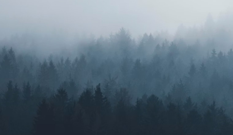
Foggy Morning Commute
The thickest fog looks most likely north of Oklahoma City through about 9 a.m. CST, where visibility could drop below a half‑mile at times. If you hit the gray stuff, ease off the gas, use low‑beam headlights and keep an eye out for slick spots on bridges and overpasses if temperatures are hovering at or just below freezing. The National Weather Service is flagging these fog and freezing‑fog concerns for north‑central Oklahoma today.
Afternoon Winds and Fire Risk
By midday, winds turn westerly and pick up, helping push temperatures into the upper 60s while kicking up some gusts. That drier, breezier air will bump up fire danger across far western Oklahoma this afternoon, so outdoor burning is discouraged and any smoke should be reported quickly. Details on fire‑weather concerns and current burn bans are available from Oklahoma Forestry Services.
Warm Pattern Into Next Week
The mild pattern holds into Friday and the weekend, with afternoon highs climbing into the 70s. The next shot at measurable rain does not show up until around Tuesday next week. Early‑week rain chances look limited, with just a slight chance of showers Tuesday and scattered possibilities into midweek. Temperatures are expected to stay well above typical early‑February levels through at least early next week.
Plan Ahead
Give yourself extra time for the Thursday morning drive wherever fog is reported, and be ready for road conditions to change quickly in the first few hours after sunrise. If you live or work in western counties, hold off on any planned controlled burns and check local county notices before lighting anything outdoors. Keep an eye on updated local forecasts if you are counting on the warm, dry weather for outdoor plans later in the day.


