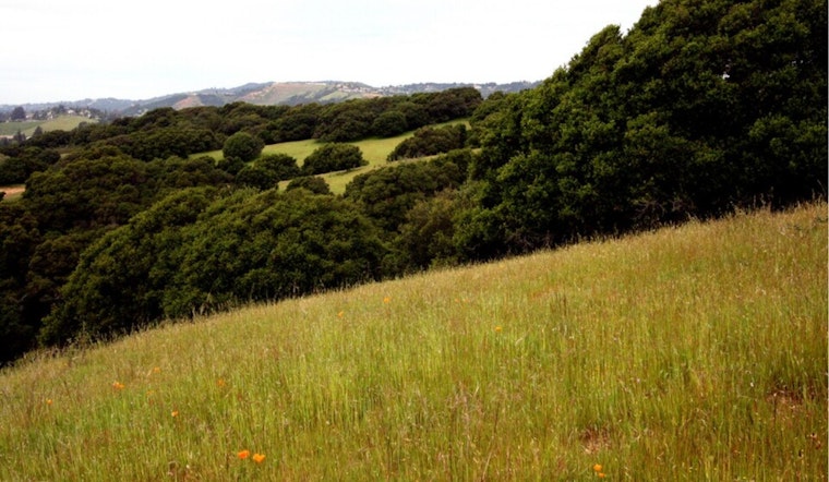
California’s trees, grasses, and soils are quietly doing overtime on climate duty. A new state inventory finds that the state’s natural and working lands soaked up nearly twice as much carbon as wildfires spewed into the air over the last two decades. Even after a run of brutal fire seasons, the landscapes remain a net carbon sink overall, but the cushion is getting thinner. That shrinking margin is already fueling a policy fight over how heavily California should rely on nature to hit carbon neutrality versus moving faster on targeted wildfire risk reduction.
What the inventory found
The California Air Resources Board has released the second edition of its Natural and Working Lands Carbon Inventory, which concludes that plants and soils have absorbed about twice the carbon emitted by wildfires since 2001 and that nearly 5 billion metric tons of carbon are now stored across the state’s landscapes. According to the California Air Resources Board, more than 70% of that carbon is locked up in forests and shrublands, and the update relies on improved satellite and ground-based measurements. State environmental officials quickly boosted the numbers on social media, with CARB sharing the topline findings on X.
Nature is CA's ally for carbon neutrality.
— CARB (@AirResources) February 10, 2026
A new CARB inventory reveals our natural & working lands absorbed nearly twice the carbon lost to wildfires— demonstrating the important role of nature in the state’s fight against climate change 🌲📈
➡️ https://t.co/xkMNzl0lGX pic.twitter.com/GVtEAEaAMR
Where losses are happening
The same inventory carries a warning label. While lands sequestered about 45 million metric tons of carbon between 2001 and 2022, total stocks fell by roughly 214 million metric tons during the 2014 to 2022 period, with the steepest drops occurring where forests were converted to shrublands or grasslands. “California’s natural and working lands are proving to be powerful allies in our effort to address climate change,” CARB Chair Lauren Sanchez said in the agency’s statement, while cautioning that extreme fire years can overwhelm nature’s ability to pull carbon from the atmosphere. CARB reports that average annual wildfire emissions are about half the carbon absorbed by plants and soils, but that in severe years that balance can flip, as detailed by the California Air Resources Board.
Prescribed fire and the science
The inventory leans on a familiar solution set. CARB highlights prescribed fire and targeted fuel treatments as tools that can cut long-term wildfire risk while preserving carbon benefits when they are carefully designed and overseen. A critical review in the peer-reviewed Journal of the Air & Waste Management Association found that prescribed burns generally generate far lower PM2.5 and CO2 emissions per hectare than uncontrolled wildfires and can be timed to reduce air quality impacts. California programs are already channeling money and staff time into local prescribed-burn associations and training to build up safe, low-intensity burns on both private and public lands, according to UC Cooperative Extension.
Policy tools: LiDAR, flux towers and 30x30
State officials say the new accounting will not just sit on a shelf. Agencies plan to use the inventory to steer planning, funding and on-the-ground work, from California’s 30x30 conservation pledge to new mapping and monitoring projects. The Office of Emergency Services and partner agencies have rolled out statewide LiDAR datasets and helped install redwood flux towers that track carbon flows in real time, tools they say will help zero in on priority areas for treatments and restoration, according to Cal OES. The inventory is also folded into broader conservation goals, including the 30x30 effort described at CaliforniaNature.ca.gov.
Bottom line for Californians
For residents watching both smoke plumes and climate targets, the message is clear but cautious. Nature is still a crucial carbon partner, yet a few catastrophic fire seasons can wipe out years of quiet gains unless the state scales up prescribed burning, fuel treatments and fast, data-driven interventions. The numbers are expected to influence CARB’s next scoping plan updates and help decide where wildfire resilience dollars land in the coming months. For now, the inventory gives land managers and communities a sharper tool to weigh the tradeoffs between safeguarding carbon stores and cutting fire risk.


