Portland gets one more sun-soaked, mild afternoon on Wednesday, Feb. 4, with highs near 61°F, before the weather flips tonight as stronger east winds start cranking across the metro. Through Friday, look for pockets of morning valley fog and chilly nights that will be cold enough for patchy frost in sheltered low spots.
Afternoon Winds Pick Up
A Wind Advisory is in place for the eastern Portland metro from 10 PM Wednesday, Feb. 4, through 1 PM Thursday, Feb. 5, with the most intense gusts expected from Troutdale east. Eastern neighborhoods could see gusts close to 40-45 mph, while exposed ridgetops such as Crown Point and Three Corner Rock may briefly gust 50-55 mph. Winds should back off Thursday evening into Friday as the pressure gradient relaxes, although overnight gusts could still jostle high-profile vehicles and send unsecured outdoor items flying, according to the National Weather Service Portland.
Fog, Frost And Air Stagnation
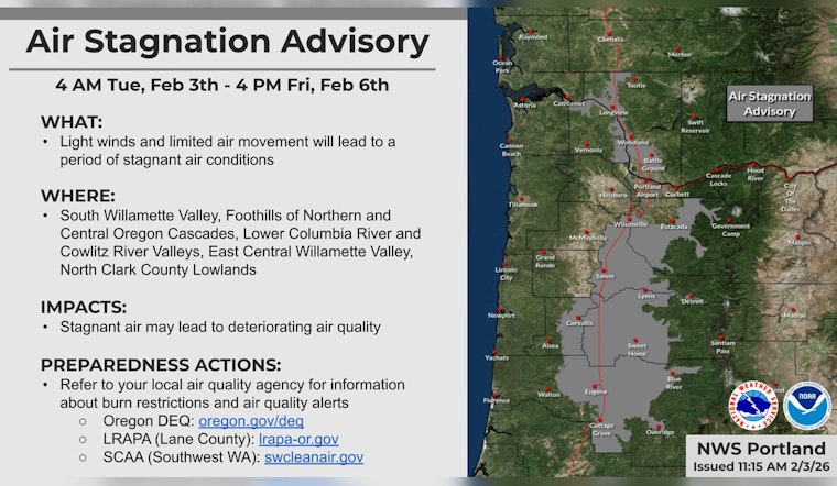
Light surface flow beneath a strong inversion will allow fog and low stratus to form this morning in sheltered pockets of the Willamette Valley, with most spots expected to clear to sunshine by late morning. Clear nights and calm winds Thursday and Friday will favor frost in the colder lowlands, so gardeners and early-morning drivers should be ready for slick or crunchy surfaces. An Air Stagnation Advisory is in effect through 4 PM PST Friday for parts of the Willamette Valley and nearby lowlands, a setup that can trap pollutants and drag down air quality for people with respiratory issues, as reported by OPB.
Marine And Beach Hazards
A long-period westerly swell has pushed seas into the 9-11 foot range, and a Small Craft Advisory remains in place for the coastal waters through Friday. At the same time, a Beach Hazards Statement warns of sneaker waves along the north and central Oregon coast and southern Washington through early Thursday. Beachgoers and razor clam diggers are urged to stay well back from the water and avoid rocks and jetties while the statement is in effect.
What To Know For Your Commute
Gusty crosswinds are likely on I-84 through the Columbia River Gorge and on exposed bridges late Wednesday night and early Thursday, so plan on extra travel time and be ready for sudden gusts on ramps and at interchanges. Secure loose patio furniture, tarps, and other lightweight gear, and steer clear of driving high-profile vehicles through the windiest stretches during the advisory window.


