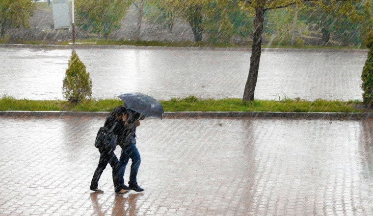
Honolulu woke up Sunday, February 8, 2026, to soaking rain, gusty northeast winds and a muggy 64°F start, with humidity stuck in the mid 80s. The rough weather is not a quick hit. Forecasters expect rounds of heavy showers and a few thunderstorms to keep firing through Sunday and into Monday, bringing a risk of localized flash flooding on windward slopes and in low-lying city spots.
The National Weather Service has a Flood Watch posted statewide through Monday afternoon, along with a High Wind Warning stretching from 6 a.m. HST Sunday, February 8, to 6 p.m. HST Monday, February 9.
Warnings And Timing
Trade winds will crank up through Sunday as the pressure gradient tightens. East-northeast winds are expected to blow steadily from the high teens into the mid 20s mph, with exposed ridges and downslope areas seeing gusts that could hit around 60 mph. The Flood Watch remains in place for every island through Monday afternoon, and the High Wind Warning is also statewide for the same Sunday morning to Monday early evening window, according to the National Weather Service.
Heavy Rain And Flooding Threat
Passing showers and embedded thunderstorms could drop 1 to 2 inches of rain in many neighborhoods today, with higher totals where storms park along windward mountains. Those terrain-locked downpours are the main flash-flood concern. Already moist ground means runoff will pile up faster, raising the odds that flood-prone roads and low-lying streets see closures. Drivers should expect pockets of urban flooding and temporary blockages in areas with poor drainage.
Marine And Surf Concerns
Out on the water, conditions look just as rough. Small craft advisories and gale watches may be in play for many channels, and surf along east-facing shores is expected to build tonight into Monday. Beachgoers and boaters are urged to follow local advisories, steer clear of heavy surf zones with strong rip currents and move small vessels to more protected moorings where possible. Large, wind-driven seas will keep marine operations hazardous through Monday.
What To Do
Residents are urged to secure anything that can turn into a projectile in strong winds. Patio furniture, grills and trash bins should be brought inside or tied down. Avoid driving through standing water, and use extra caution on exposed stretches of road; taller vehicles can be tricky to control in strong crosswinds. Keep phones charged, have a backup power pack handy and keep an eye on county Civil Defense pages for real-time updates on shelters and road closures.
Legal Implications
Gov. Josh Green has issued an emergency proclamation ahead of the worst of the storm, which activates state resources and formally urges the public to prepare. The governor's office and the Hawaii Emergency Management Agency outline preparedness steps and how to sign up for alerts. For official guidance and detailed preparation tips, see the Hawaii Emergency Management Agency. County Civil Defense sites will provide the latest word on shelters, closures and any additional emergency actions.
More From Hoodline
This story updates our earlier look at the weekend storm setup. For how the soggy pattern first took shape, check out our weekend washout forecast. We will continue to update as new warnings are issued and county advisories change.


