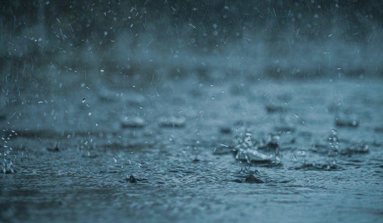
Light rain slid across Honolulu early Saturday and temperatures hovered near 696F at Daniel K. Inouye International Airport as a slow-moving front stalled near Maui, setting the stage for periods of heavy rain and possible flash flooding through Monday. Occasional downpours and brisk northeast winds are expected to snarl commutes and dampen outdoor plans, especially across windward and urban neighborhoods.
What To Expect This Weekend
By early Saturday, Daniel K. Inouye International Airport was already reporting light showers and temperatures near 696F. A Flood Watch is in effect from Saturday, February 7 at 12:00 PM HST through Monday, February 9 at 6:00 PM HST for all the main Hawaiian islands, with forecasters warning that many spots could see 1 to 2 inches of rain and locally higher totals where bands stall.
Saturday’s forecast calls for a high near 766F with northeast winds of 17 to 25 mph and gusts up to 36 mph. Showers will be frequent, and some will pack embedded heavier downpours. According to NWS Honolulu, thunder is possible from Sunday into Monday, with the greatest flash-flood risk focused over windward slopes and low-lying urban areas.
Local Impacts And Advisories
State and county officials are telling residents not to wait until the rain is pounding on the windows to get ready. They are urging the public to prepare for flooding, possible power outages, and to sign up for emergency alerts before conditions worsen.
The Hawai9i Emergency Management Agency is recommending steps such as planning for outages and securing loose outdoor items, and it stresses that the most dangerous weather is expected Sunday night into Monday. For detailed preparedness guidance, see the Hawaii Emergency Management Agency.
Winds, Surf And Marine Concerns
A High Wind Watch is posted from Sunday, February 8 at 6:00 AM HST through Monday, February 9 at 6:00 PM HST for exposed and downslope areas, where east-northeast trades could gust above 60 mph. Those kinds of gusts can bring down trees and power lines and make life difficult for high-profile vehicles.
Surfers and beachgoers should brace for elevated surf and hazardous currents, with High Surf Warnings and Advisories in effect for several exposures today, while surf along east-facing shores is expected to ramp up late in the weekend. Mariners are being told to heed small craft and gale watches as conditions deteriorate from Sunday into Monday, according to NWS Honolulu.
Practical Tips
Move cars off low-lying streets, avoid driving through standing water, and check local county pages or Civil Defense alerts before heading out. If you rely on medical devices that need electricity, plan for potential outages and keep necessary supplies close. Expect delays on the roads and at outdoor events, and consider postponing nonessential travel when the heaviest downpours move through.


