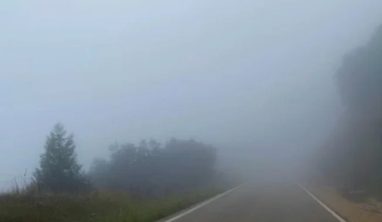
Knoxville is starting Wednesday under a thick, gray curtain, with dense fog hugging the region, temperatures stuck in the mid 30s, and visibility in some spots down to a quarter mile or less. A Dense Fog Advisory is in effect until 9:00 AM EST Wednesday, February 4, 2026, and the murky start could slow or delay the morning commute. Drivers are urged to stick with low beam headlights, take it easy on the gas, and leave extra room to stop while the fog hangs around.
This Morning
The National Weather Service in Morristown has issued the Dense Fog Advisory through 9:00 AM local time, warning that visibility could drop to one-quarter mile or less and reminding motorists to “slow down, use your headlights, and leave plenty of distance ahead of you.” National Weather Service Morristown notes that fog may linger longer in valley neighborhoods and over spots that still have snowpack from the weekend.
Afternoon Into Tonight
Clouds will be stubborn this afternoon with a chance of light rain or drizzle, then a shift to scattered rain and snow showers later in the day. Highs will top out near 41°F before slipping into the upper 30s. Tonight the low will fall to around 23°F with a 30 to 40 percent chance of snow showers, and any new snow should stay light, generally under one-half inch in the valleys and up to around an inch on the highest East Tennessee ridges. Winds remain light, from the north around 0 to 5 mph.
What To Watch
Once temperatures drop below freezing overnight, any damp pavement left behind can refreeze. Forecasters are flagging the risk of black ice Thursday morning, especially on bridges, overpasses, and shaded side streets. If you need to be out after dark tonight or early Thursday, plan on slick patches where meltwater refreezes and give yourself extra time. Local road crews are likely to treat main routes first, so expect neighborhood and secondary streets to stay more hazardous.
Looking Ahead
A stronger front slides in on Friday, bringing gusty southwest winds around 5 to 15 mph with possible gusts near 25 mph and a brief chance for a mix of precipitation Friday night. A warmer setup builds in early next week, with highs climbing into the upper 50s to around 60°F by Monday and Tuesday. Forecasters suggest keeping an eye on short-term updates in case the timing or coverage of these systems shifts.
More
For more on why our valleys can stay socked in while the hills start to clear, see our earlier coverage, why lowlands and snowmelt can trap fog into the morning commute. That story breaks down how local terrain and leftover snow help keep the clouds parked right over East Tennessee drivers.


