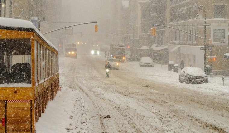
New York City woke up to a gray, soggy start on Sunday, February 22, 2026, with fog and temps hovering near 35°F, and it is only the opening act. A powerful nor'easter is spinning up off the Atlantic, and a Blizzard Warning is now in effect across all five boroughs for Sunday night into Monday, February 23. Officials are already warning New Yorkers to brace for heavy snow, fierce winds and coastal flooding that could snarl travel and knock out power.
When It Hits
Precipitation is expected to start as a rain and snow mix Sunday morning before flipping to steady snow by Sunday evening. The strongest snow bands are forecast to set up late Sunday night into Monday morning. The National Weather Service expects the core of the storm to hit roughly between 10 p.m. Sunday and 10 a.m. Monday, with snowfall rates of 1–2 inches per hour and citywide totals commonly in the mid-teens. Coastal neighborhoods could see even higher amounts, with whiteout conditions likely, according to the National Weather Service.
Winds, Coastal Flooding And Travel
Strong northeast winds will team up with the falling snow to create blowing and drifting, with inland gusts forecast to reach 35–45 mph and coastal gusts up to 55–65 mph. That combination raises the risk of downed branches and power outages. Onshore flow and high winds are also expected to produce 1–2 feet of inundation in vulnerable waterfront areas around the Sunday night high tide. New York City Emergency Management has issued a hazardous travel advisory, opened warming centers in all five boroughs and urged residents to avoid nonessential travel. For neighborhood-level updates, check Notify NYC or call 311, per NYC Emergency Management.
Transit, Airports And Commutes
Public transit users should be ready for delays and potential service changes, especially on exposed bus routes and commuter rails. Subway service could slow where lines and station entrances are at or above ground, thanks to blowing and drifting snow. If you are flying, double-check with your airline before heading to JFK, LaGuardia or Newark, since carriers often cancel flights in advance of major blizzards. Monday’s commute, for those who have to make it, could be extremely difficult.
How To Prepare
Now is the time to charge phones, refill prescriptions, top off fuel and pull together a winter emergency kit if travel cannot be avoided. If you do get stranded, stay with your vehicle and call for help rather than trying to walk out in low visibility. When conditions ease, residents are asked to clear safe paths on sidewalks and around fire hydrants. For more background on how this storm developed, see our earlier storm coverage. We will update this post as warnings and advisories change.


