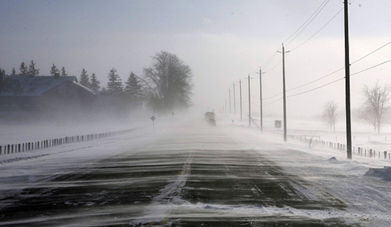
Clouds, borderline freezing temps and a few stray flakes are teaming up to make Monday, February 23, 2026, a little dicey around Reagan National Airport, where it is sitting near 32°F early this morning. There is a slight chance of light snow before 11 a.m., and a Special Weather Statement warns that any lingering wet spots could refreeze on untreated roads, bridges and sidewalks, setting up slick patches for the morning rush. Temperatures should claw their way to a high near 40°F this afternoon as winds swing around to the northwest and conditions turn noticeably breezy.
Afternoon Winds Pick Up
Northwest winds are expected to ramp up this afternoon, with sustained speeds near 20 mph and gusts reaching about 35 to 36 mph. That will make it feel colder than the thermometer suggests and could blow light snow or slush back onto roadways. According to the National Weather Service, gusts may be stronger over the Blue Ridge and western Alleghenies, where wind advisories remain in effect and gusts could reach 50 mph at higher elevations. Drivers should brace for blustery crosswinds on bridges and exposed highway stretches.
Morning Commute and Transit
Road crews are already finding slushy, wet surfaces in spots this morning, and untreated pavement may refreeze as temperatures dip back below freezing during the commute. Metro and bus riders are urged to check for route changes and snow detours before heading out, since WMATA posts service updates and winter plans on its site. We ran a detailed forecast yesterday that outlined expected accumulations and travel tips, so see our sloppy snow setup for a deeper dive. Build in extra time and take particular care on bridges, ramps and untreated sidewalks.
What To Expect Later This Week
Fast-moving systems will sweep through Tuesday night into Wednesday, but only a few light snow showers are expected, with little accumulation likely across the immediate metro area. Wednesday, February 25, 2026, should feel noticeably milder, with highs in the mid 50s after a morning chance of rain or snow. A stronger system on Thursday could bring a mix of rain and snow with a higher chance of precipitation. Travelers should keep an eye on updates later in the week, since the exact timing and type of precipitation may shift.


