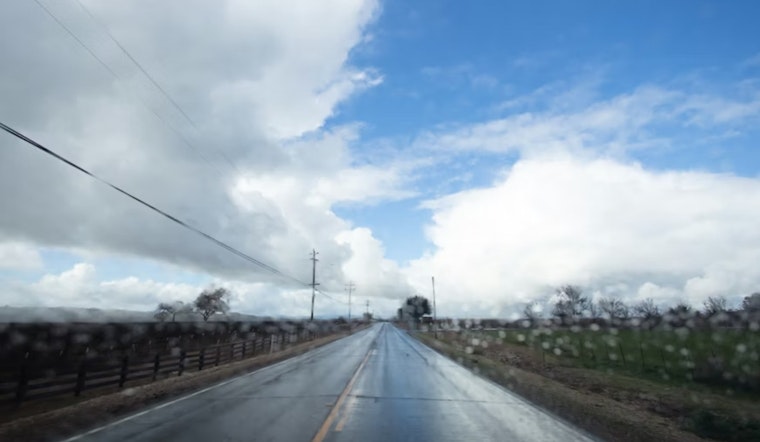
San Jose started today, on a mellow note, with clear skies and a mild 59°F at Mineta San José International. That quiet stretch will not stick around for long. A plume of Pacific moisture is sliding into the South Bay this afternoon and will spread rain across the city. Most valley neighborhoods can plan on light to moderate showers through the evening, with a high near 69°F, while the real soaking targets the North Bay and its surrounding mountains. Expect wet roads for the evening drive and pockets of patchy fog before daybreak tomorrow.
Afternoon Rain And Commute
Rain is likely across San Jose from Tuesday afternoon into the evening, with the bulk of the daytime showers arriving between early afternoon and late evening. Forecasters are calling for around a tenth to a quarter of an inch in the valley, with higher amounts in the hills to the north. According to the National Weather Service in San Francisco, the North Bay valleys may see 1–2 inches, with some mountain spots picking up as much as 4 inches.
Evening Winds And Fog
Southerly breezes will ramp up this afternoon, turning gusty on exposed ridgelines and near the coast, and making for choppy conditions on the water. Temperatures will slip into the mid-50s overnight, and low-lying areas can expect patchy fog before sunrise tomorrow, cutting visibility during the early commute. If you have evening plans or need to be on the road early, leave extra time and keep an eye out for standing water on city streets.
North Bay Flooding And Marine Advisories
The National Weather Service notes nuisance flooding as the main flood concern across the North Bay, where the heaviest rain bands are expected to linger. Small Craft Advisories remain in effect for portions of the outer coastal waters, including zones near Point Arena and Point Reyes, through this afternoon and evening, with some advisories running until about 3 PM and others holding on into the evening near 9 PM PST. Mariners and coastal property owners should stay tuned to changing conditions. Inland, impacts are expected to be limited mostly to street ponding and slow drainage in low spots rather than any widespread or major flooding.
Rest Of The Week
Once today’s plume moves through, high pressure ridging builds back in tomorrow and brings a warmer, drier pattern through the end of the week, with afternoon highs rising into the upper 60s to mid 70s by Thursday and Friday. A weak cut-off low may approach late Sunday and persist into early next week, but ensemble guidance still indicates significant rainfall is unlikely for now. Morning fog will remain a factor for valley commuters through Thursday, especially after clear nights in the wake of today’s rain.
Hoodline Update
This story updates our recent coverage of the February storms. For more on the broader setup and earlier wind guidance, see Hoodline.
What To Do
Take it easy on wet roads, slow down for standing water, and build in extra time if you rely on transit, since local services may be delayed if showers pick up briefly. Boaters and small craft operators should respect the advisories in place through this evening, and residents near creeks or low-lying areas should secure loose outdoor items before the rain. Anyone heading out later today or early Wednesday should keep tabs on local alerts and updates from the National Weather Service.


