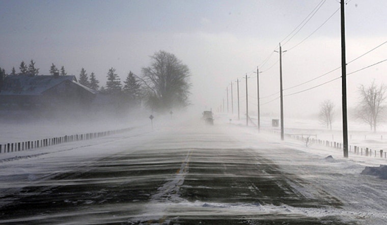
Boston wakes up Tuesday to mostly clear skies and temperatures hovering near 30°F at Logan Airport, but the calm start comes with a catch. The National Weather Service has issued a Special Weather Statement flagging patchy freezing drizzle or scattered flurries this morning that could leave untreated surfaces and elevated bridges slick. A high near 37°F is expected later, with patchy fog developing, so travelers are urged to build in extra time for the morning commute and take it slow on ramps and walkways.
Morning Commute: Light Snow, Freezing Drizzle
Isolated snow showers remain possible before 9 a.m., followed by a brief window of patchy freezing drizzle or light mixed precipitation between roughly 9 and 10 a.m., then a stretch of low clouds and fog into the afternoon. Southwest winds should stay on the light side around 3 to 7 mph, keeping highs in the mid 30s. Most treated roadways are expected to stay in decent shape, but untreated sidewalks and bridges could turn slick during that brief freezing drizzle, according to the National Weather Service.
Wednesday And The Week Ahead
A stronger system is on track for Wednesday, with rain likely after 9 a.m. and a transition to snow Wednesday night. Accumulating snow is possible across parts of southern New England Wednesday afternoon into Wednesday evening, especially in higher elevations from the northern Worcester Hills into Franklin County. Forecasters say confidence remains low on exact snow amounts and on where any more significant snowfall will set up, and the timing will largely control how disruptive it becomes. We broke down the broader setup in our February 16 coverage of thin ice as midweek snow showers roll back in, and details are expected to be sharpened in later forecasts.
Boaters And Commuters
Small Craft Advisories remain in effect for parts of the southern waters into Thursday morning, and seas will stay choppy on the outer waters through Wednesday night. Ferry riders and small-vessel operators should check with carriers before heading out and be ready for possible delays. On land, the usual winter rules apply, with slower speeds and extra stopping distance a smart move.
Bottom Line
Expect a potentially slick start to Tuesday in shaded and untreated spots, keep an eye on forecast updates for Wednesday's snow threat, and give yourself some extra commute time. If you have outdoor plans later this week, stay tuned to the forecast, since multiple chances for wintry precipitation are expected through the weekend.


