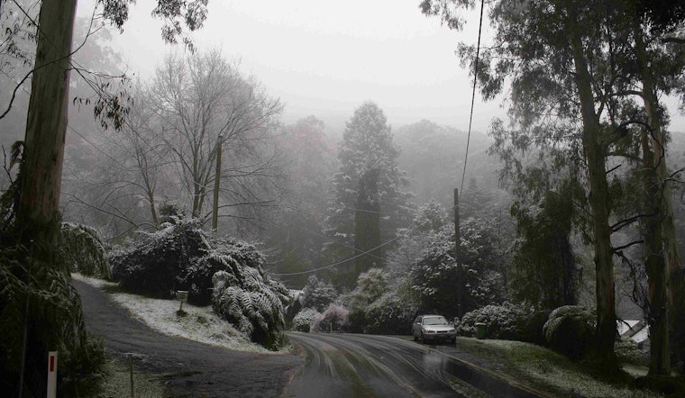
Boston woke up around 30°F on Friday, February 20, under mostly cloudy skies, and the weather is only getting trickier from here. A messy, shape-shifting system is sliding through today, with light snow expected late this morning that flips to rain in the early afternoon, then changes back to snow tonight. In other words, a recipe for slick spots just in time for the evening commute.
The National Weather Service has a Winter Weather Advisory in place from 10 a.m. Friday through 7 a.m. Saturday for much of interior southern New England. The advisory calls for accumulating snow, sleet, and pockets of freezing rain that could turn roads and bridges slippery, according to the National Weather Service.
Today And Tonight
Between about 10 a.m. and 1 p.m., forecasters see a chance for light snow across the Boston area, followed by a likely switch to rain roughly from 1 to 4 p.m., with afternoon highs climbing into the upper 30s. East winds stay generally on the lighter side. After sunset, readings slide back into the low 30s and the precipitation flips back to snow, with minor accumulation on the table: a coating to about a half inch in the city and somewhat higher totals inland.
Commute And Coastal Notes
The timing is what will make the Friday evening drive home the trouble spot. Wet pavement left behind by afternoon rain can refreeze after dark, turning ramps, bridges, and neighborhood side streets greasy and sneaky-slick. Offshore, outer coastal waters are expected to turn choppy tonight into Saturday, and a Small Craft Advisory is posted for some local waters. Ferry passengers and small-boat operators should double-check with their carriers before heading to the dock.
Weekend Outlook
Saturday looks cold and mostly cloudy, with only a slight chance of a few light snow showers and generally limited additional accumulation, under an inch in most spots. Forecasters are keeping an eye on a stronger coastal system for late Sunday into Monday. Current guidance leans toward a track just offshore, but the exact path, and which areas see heavier snow or coastal wind, is still uncertain. For evolving details and context, check out the ongoing Black Ice coverage.
How To Prepare
If you are heading out this afternoon or evening, build in some extra travel time, ease off the gas on ramps and bridges, and be ready for slick patches on untreated side streets. Before you go, check MBTA and ferry operator sites for any service changes, and keep an eye on updates from the National Weather Service for any shifts in advisories or timing.


