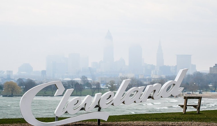
Cleveland rolled into Thursday, March 5, 2026, under light rain, dense fog and a chilly 39°F, with visibility dropping hard in low-lying neighborhoods. A Dense Fog Advisory is in place for the southern half of the forecast area through 10 AM EST, so drivers should expect slowdowns on bridges and surface streets this morning. If you have to be on the road before midday, stick with low beams, ease off the gas and give yourself extra room to stop.
Dense Fog This Morning
The Dense Fog Advisory runs until 10 AM EST across much of the southern half of the region, with some spots dropping to one-quarter mile visibility or less in low areas and along the lakefront. The fog is expected to lift gradually around midday, but showers pushing in from the west will become more persistent through Thursday, March 5, with a high near 54°F and rain likely through the afternoon. The National Weather Service is keeping close tabs on the situation and will adjust headlines and timing as today’s fog and rain evolve. National Weather Service
Rain And Thunderstorms Through Saturday
Forecast models now call for several rounds of showers and thunderstorms through Saturday, with total rainfall adding up to roughly three-quarters of an inch area wide and localized totals up to an inch possible in the far south. A few embedded thunderstorms are on the table this afternoon and evening, most likely south of US-30, and could bring brief heavy downpours and sharply reduced visibility. After a short lull late Thursday night into early Friday, scattered showers return Friday, followed by a more organized round of rain and storms on Saturday.
Weekend Outlook
Temperatures leap into the upper 60s on Friday, March 6, and Saturday, March 7, ahead of a cold front that will deliver the best shot at storms. Forecasters say Saturday night is the most favorable window for stronger storms across parts of the region, which could put a dent in evening outdoor plans. For more on how we got here from the week’s murky start, see our earlier coverage of the dense-fog start to the week.
What To Watch
Heavy rain, brief flooding in poor-drainage spots and gusty winds are the main concerns to watch. Southerly wind gusts around 24 mph are possible Friday night on land, and winds over Lake Erie may peak near 25 knots (about 29 mph) as the front moves through Saturday. If thunderstorms fire up Saturday evening, head indoors and steer clear of flooded roads, and make sure small outdoor events have a solid backup plan. For the latest watches, advisories and fine-tuned timing, keep an eye on updates from the National Weather Service.
This story will be updated if the Dense Fog Advisory is expanded or if any additional warnings are issued. If you have outdoor plans this weekend, monitor the forecast closely and be ready to shuffle Saturday evening plans if storms move in.


.jpg)