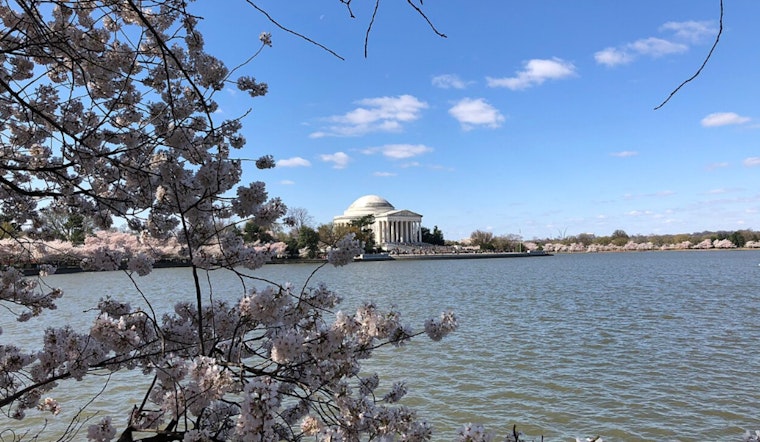
Spring's most photographed weekend in Washington is shaping up to be a bit of a tease: a chilly start followed by a fast warm up. Saturday may look postcard perfect, but the feel will be another story, with gusty winds likely to make the morning a little rough for anyone lingering along the Tidal Basin. Layers are your friend, and so is a flexible game plan.
According to WJLA, Saturday will be bright but blustery, with a brisk north to northeast wind keeping highs stuck in the upper 40s to near 50. The station's First Alert Weather blog flat out tells anyone headed to the Tidal Basin to bring a warm jacket, and it features a Tidal Basin shot credited to Marco Tavares/7News to drive the point home. WJLA notes that Sunday should feel noticeably milder as winds shift, opening a more comfortable viewing window.
Sunday and the Warm-Up
The National Weather Service point forecast for downtown Washington calls for southerly winds on Sunday and afternoon highs near 60, then a jump to around 70 on Monday and highs into the 80s by Tuesday. By Wednesday, temperatures could top out in the mid 80s with increasing clouds and a growing chance of late day showers or an evening thunderstorm. If those rapid swings verify, the bloom cycle will move quickly.
What This Means for the Blooms
The National Park Service projects peak bloom in the March 29 to April 1 window and notes that blossoms typically remain for about seven to 10 days once peak is reached. The forecasted surge into the 70s and 80s next week will accelerate petal drop and will likely shorten the Tidal Basin's prime viewing period, a point also flagged by WJLA. Visitors hoping to dodge the biggest crowds are advised to aim for early morning weekday visits and to keep an eye on updates from the National Cherry Blossom Festival and the National Park Service for any temporary route changes around restoration zones.


