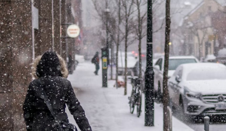
Boston is getting the classic New England two-step this week: a little light snow to start Sunday, followed by a serious plunge into arctic cold that will make Monday morning feel like mid-January all over again.
It is starting off clear and brisk at Logan this morning with temperatures near 37°F, but forecasters say light snow is likely across Boston on Sunday, March 1, 2026, between about 9 a.m. and 3 p.m. Most neighborhoods can expect just a dusting to around an inch.
Morning Through Afternoon
Snow should move in from the west by late morning and then taper toward sunset. Inland spots have the best shot at picking up close to an inch, while the coastline is expected to see lighter totals. Northwest winds of 6 to 13 mph will hold afternoon highs near 33°F, which should keep snowfall rates on the modest side and limit how quickly it piles up. That is all according to the forecast from the National Weather Service Boston/Norton.
Monday's Arctic Snap
Once the arctic front sweeps through late Sunday, temperatures take a sharp dive. In the Boston area, lows are expected to drop to around 6°F by early Monday, March 2, 2026, with wind-chill values as low as -8. Afternoon highs will only crawl into the mid 20s. Blustery northwest winds will add extra bite, especially away from the coast. If you have early morning plans Monday, plan on layering up and consider checking in on anyone who might need help staying warm.
Tuesday Into Midweek
The next system shows up quickly. A weak low on Tuesday, March 3, 2026, is expected to begin as snow, then flip to freezing rain and finally to plain rain as warmer air noses in. Forecasters note that the exact timing and mix of precipitation types are still uncertain, so it is worth keeping an eye out for updates. Highs near 40°F Tuesday should give way to a wetter Wednesday with readings in the 40s and a milder Thursday.
Out on the water, mariners are looking at freezing-spray and small-craft advisories on local coastal waters into Monday morning, and nonessential trips are best skipped until conditions ease. For specific zone forecasts and marine notices, check the latest from the National Weather Service Boston/Norton.
What To Do Now
Plan on giving yourself some extra time for driving on Sunday, and if you park outside overnight, make sure your car’s exhaust pipe is clear before you start it up. Keep an ice scraper and a few extra warm layers within reach. Road and transit travel may run slower than usual, so build in a buffer if you commute and keep an eye on advisories. We will share updates if the timing or type of precipitation shifts.


