Honolulu is waking up to a sticky, mostly cloudy morning, with Daniel K. Inouye International Airport hovering around 75°F and the humidity cranked way up. Bands of heavy showers and thunderstorms are lining up over the islands through Saturday, which means drivers can expect sudden drops in visibility and fast-changing road conditions. Low-lying streets and clogged drains can fill quickly during the worst downpours, slowing commutes and triggering temporary closures as officials warn of flooding and gusty winds over the next several days.
Rain And Flooding
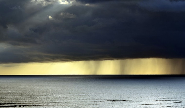
The main concern in the short term is frequent, slow-moving bands of heavy rain. Local totals of 2 to 3 inches are possible today, with higher pockets if any of those bands decide to stall over one spot. According to the National Weather Service Honolulu, a Flood Watch is in effect through Saturday afternoon, and flash flooding of streams and low-lying roads is on the table. Forecast discussions note that some locations could see more than 4 inches of rain through Friday, raising the odds of urban and small-stream flooding. If the situation escalates, expect flash flood warnings and respect any road-closure orders that follow.
Legal Implications
The governor has already declared a state of emergency to get ahead of the storm impacts, freeing up resources, authorizing the National Guard, and streamlining emergency contracting, per the Office of the Governor. The proclamation temporarily suspends certain administrative rules so agencies can move faster and activates the Major Disaster Fund to help pay for repairs and cleanup. County directives and road closures issued under this emergency declaration take priority, so residents are urged to follow county and state instructions. Anyone needing assistance or shelter should reach out to their county emergency management office.
Winds And Travel
South to southwest winds are expected to ramp up this evening and stay strong into Friday and Saturday, with a High Wind Watch in place and gusts up to 60 mph possible in exposed and upslope areas. The National Weather Service Honolulu notes that communities sitting north and east of steep mountain slopes are especially vulnerable to damaging gusts and falling trees. Travelers and residents should plan for choppy south-facing surf and the potential for gale-force conditions on some coastal waters, and use extra caution when driving high-profile vehicles or heading out on a boat. It is a good time to tie down or stash loose outdoor gear and bring pets and vulnerable family members inside when the winds start howling.
How To Prepare
Avoid driving through standing water, remember the old rule to turn around, don’t drown, and move vehicles off streets that you know tend to flood if you have the option. Charge phones, put together a small emergency kit with water and essential medications, and keep tabs on local road-closure and shelter updates from your county. Outdoor plans such as hikes and coastal outings are better saved for after this system moves on, so follow the guidance posted on county and state emergency pages. Check in on neighbors who might need a hand, especially older adults or those with mobility challenges.


.jpg)