Oklahoma City is starting Friday under clear, mild skies around 64°F at Will Rogers World Airport, but the calm is on the clock. Today, Friday, March 6, 2026, strong south winds will shove temperatures into the mid to upper 70s and drag in a chance of showers and thunderstorms before mid afternoon. A cold front follows late Friday night, flipping the script to a much cooler, breezy Saturday.
Afternoon Winds Pick Up
By this afternoon, south winds of 17 to 22 mph with gusts up to 33 mph are expected, which could make for a jittery commute and send any loose lawn chairs on a short road trip. The chance of showers and thunderstorms runs about 40% through mid afternoon. Most spots will only see brief, light rain, but a few storms could punch out some stronger gusts. For the latest details, check the National Weather Service.
Friday Night Into The Weekend
A second round of showers and a slight chance of thunderstorms could move through late Friday night before midnight. After that, skies clear with temperatures dropping to around 43°F by early Saturday. Saturday turns noticeably cooler, with highs near 58°F and a steady north breeze keeping things feeling crisp. By Sunday, temperatures rebound into the low 70s, much better news for outdoor plans. If you are heading out Friday evening, grab a rain jacket and count on gusty winds hanging around.
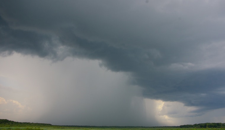
Fire Weather And Severe Risk
Forecasters have highlighted elevated to near critical fire weather conditions across parts of western Oklahoma Friday afternoon, where gusty southwest winds and low humidity will combine to make grass or brush fires spread quickly. The most likely zone for severe storms Friday will be mainly east of I-35, while western counties should keep an eye out for fast-moving fires under dry, windy conditions. There is also a renewed severe storm threat on Tuesday, March 10, 2026. Stay ready to move indoors if a watch or warning is issued, and skip outdoor burning Friday in western areas. For more, see the National Weather Service.
How To Prepare
Secure loose patio furniture, trash bins, and anything else light enough to turn into airborne clutter, and have an indoor backup plan for afternoon or evening activities. Give yourself extra time on commutes when winds peak. We first tracked this warming and windy pattern in a March 3 update on winds howling as late-night storms lined up, and today's forecast sharpens the timing and fire weather concerns for western areas. Keep phone alerts on and refresh forecasts before heading out.


