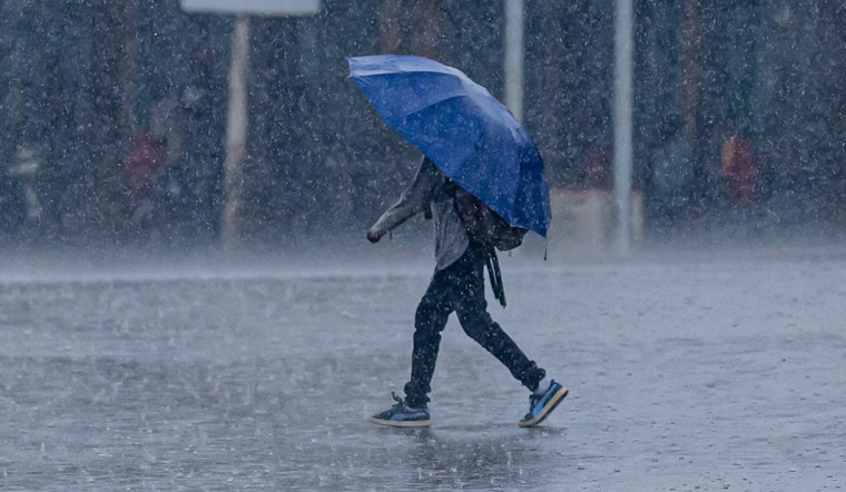
Monday, March 16, 2026, is starting gray and muggy in Washington, D.C., with cloudy, humid air and temperatures around 61°F at area observation sites early this morning, but the calm will not last. A strong cold front is set to plow through this afternoon, driving temperatures up to a high near 73°F and triggering a round of showers and thunderstorms that will overlap with the afternoon and evening commute. Some storms could turn severe, with damaging straight-line winds, a brief tornado risk, and sudden heavy downpours that may cause localized flooding. Commuters should be ready for gusty conditions and possible short power outages right when the region tries to get home.
Afternoon Severe Threat
Showers and thunderstorms are likely from about 8 a.m. to 2 p.m., with around a 90% chance of precipitation and new rainfall totals of roughly one-half to three-quarters of an inch, according to the National Weather Service. Forecasters note that strong vertical wind shear combined with a fast-moving squall line could generate damaging wind gusts, locally stronger where the line bows out, and there is a small but meaningful risk for a brief tornado. The most intense storms are expected to slide east into the I-95 corridor during the late afternoon and evening rush, timing that will not do drivers any favors.
Afternoon Winds, Tides, And Boaters
Southerly gusts ahead of the cold front will pile water up on the Chesapeake Bay and tidal Potomac. A Coastal Flood Watch is in effect for vulnerable spots, and Annapolis may touch minor flooding around the afternoon high tide. Mariners are urged to stay off the water this afternoon, with Gale Warnings and Small Craft Advisories posted for parts of the Bay. On land, residents should secure loose outdoor furniture, and anyone traveling along tidal roads should budget extra time in case of splash-over or minor flooding.
Tonight Into Tuesday: Rapid Cooldown
Showers and thunderstorms will linger into the overnight hours and should taper off after about 2 a.m., but not before some locations pick up another 0.75 to 1.0 inch of rain along with more strong gusts. Behind the front, temperatures will tumble, and tonight turns much colder, with lows falling into the 20s and 30s across the region. Tuesday will feel raw, with highs only near 41°F and blustery northwest winds. Expect lingering gusts Tuesday morning, and plan now to protect tender plants and any vulnerable outdoor equipment from the sudden chill.
What To Do Now
Secure patio furniture and other loose items, since the strongest storms could bring scattered power outages and downed limbs. If a tornado or severe thunderstorm warning is issued for your neighborhood, move quickly to a sturdy interior room away from windows. Transit riders should allow extra travel time and check MetroAlerts or local transit updates before heading out; agencies will share any service changes if conditions worsen. For background on how an early spring warm spell set the stage for today, see how D.C. sprinted toward 80 before the storms rolled in. Keep phones charged and make sure you have multiple ways to receive warnings through tonight.
Hoodline will update this story if watches or warnings are issued. Until then, keep an eye on the sky and on your local alerts, and move outdoor plans inside if thunderstorms approach. Stay off flooded roads, turn around if you encounter high water, and report dangerous conditions to local authorities when it is safe to do so.


