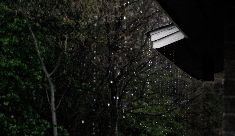
Portland is waking up to a gray, drippy start, with light rain, low clouds and temperatures stuck in the low 50s. Visibility is knocked down in a few spots, and the morning rain looks set to hang on into late morning before the atmosphere flips the switch to scattered showers and a few isolated thunderstorms this afternoon. The most likely window for rumbles is between about 2 p.m. and 5 p.m., with brief heavy downpours and gusty winds in the stronger cells. Temperatures should spike into the mid-60s for a short time, then slide back into the low 60s once the showers move through.
Afternoon Storm Risk
Later today, showers may turn locally heavy and occasionally electrified, especially across the southern Willamette Valley and near the Cascade foothills. A few cells could toss down small hail and produce erratic wind gusts. Across the Portland metro, new rainfall totals are most likely in the tenth to quarter inch range, with higher amounts piling up over the mountains. For a deeper dive on how this setup has been evolving, check out our earlier look at Portland rush-hour thunderstorms.
Midweek Cascade Snow Risk
Late Tuesday into Wednesday, a stronger Pacific front is expected to roll in with steadier rain and a cooler air mass that will drag snow levels down to Cascade pass elevations. Guidance from the National Weather Service points to an elevated chance for several inches of snow at Government Camp, Santiam Pass and Willamette Pass during the midweek period, which could complicate travel over those routes. For timing details and any updated snowfall projections, see NWS Portland. Behind this system, interior valleys should trend cooler at night with a chance of frost later in the week.
What To Expect For Trips And Plans
During the heavier downpours, wet roads and brief street flooding are the main concerns, so plan on slower commutes and a little extra travel time, especially around on- and off-ramps and low-lying intersections. A waterproof layer will be your best friend, and it is worth shifting any weather-sensitive outdoor plans into the drier breaks when you can. If your route takes you over the Cascades in the middle of the week, be ready for conditions that feel closer to winter at higher elevations. We will keep an eye on the pattern and pass along updates if watches or warnings become necessary.
Bottom line, this is more of a restless, unsettled stretch than a single blockbuster storm: showers and scattered storms through Monday, a colder and wetter system in the middle of the week with mountain snow, then a slow, gradual moderation as next week winds down.


