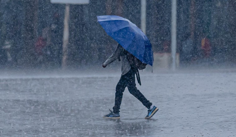
Milwaukee wakes up to light rain, patchy fog, and a sticky start on Wednesday, April 15, with temperatures hovering near 63°F this morning and a slow, soggy commute on tap. Showers and thunderstorms are expected to ramp up this afternoon and continue into the evening, with highs near 67°F before readings slide into the mid-50s overnight. Forecasters say some storms could bring heavy downpours and localized flooding as multiple rounds of rain sweep through, so keep the umbrella handy and build in extra travel time.
Heaviest Rain And Timing
The main trouble window is this afternoon into Wednesday night. Spotty showers and storms this morning give way to a higher chance of thunderstorms after mid-morning, with heavier pockets possible late in the day and into the overnight hours. New rainfall amounts of roughly 0.75 to 1.0 inch could fall in spots Wednesday night, on top of daytime totals that should land mostly between a quarter and a half inch. Southwesterly winds around 5 to 10 mph will shift to come off Lake Michigan, which could help focus storms along a boundary draped across the region. According to the National Weather Service Milwaukee, flash flooding remains a concern, and additional severe storms are possible if that frontal boundary stalls over southern Wisconsin.
Foggy Shoreline And Commute
Drivers near the lakeshore can expect reduced visibility early this morning as patchy fog hangs around. A Dense Fog Advisory for the lake zones was in effect overnight, and valley fog could creep into parts of the metro as well. Take it slow, watch for sudden drops in visibility, and keep an eye out for standing water. Flooded streets are still a risk in low-lying spots if storms repeatedly track over the same neighborhoods. For more on which areas tend to take the brunt of street flooding and recent efforts to fix it, check out our earlier Hoodline coverage on how Milwaukee is on edge as another round of storms rolls in.
Weekend Outlook
The unsettled pattern does not back off after tonight. Another round of showers and thunderstorms is likely late Friday into Saturday, with Friday night’s system capable of dropping another half inch to three quarters of an inch of rain in some spots. Cooler air follows behind that front, and Saturday night could feel noticeably colder, with some low-lying areas flirting with freezing and a slight chance of a rain and snow mix.
Plan Ahead
Bottom line: expect a wet Wednesday with patchy morning fog, then rounds of storms with pockets of heavy rain tonight and additional storm chances into the weekend. Charge your phone, secure loose outdoor items, and keep an eye on local alerts and National Weather Service updates if watches or warnings are issued.


