Oklahoma City started Wednesday on a calm note with clear skies and temperatures in the upper 50s (about 57°F). That quiet setup will not last. A quick warmup into the mid-80s combined with strengthening south-southwest winds this afternoon will help prime the atmosphere for thunderstorms later in the day, potentially turning the evening commute into a messy one.
Afternoon Into Overnight: Severe Storms Possible
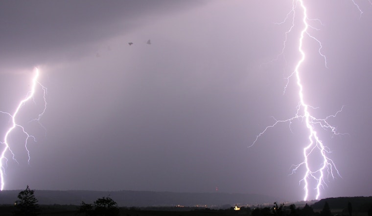
Scattered thunderstorms are expected to fire up across western Oklahoma after about 3 p.m. Wednesday and expand into the evening, with the threat of severe weather increasing across the southern Plains by nightfall. The Storm Prediction Center has outlined an enhanced area for severe thunderstorms over parts of the Plains, with large hail, damaging wind gusts and a few tornadoes on the table. Keep your phone alerts turned on, make sure you know where you would take shelter and stay on top of watches and warnings as they are issued, according to the Storm Prediction Center.
Local Timing, Winds And Rainfall
The National Weather Service in Norman expects the Oklahoma City metro to warm into the mid-80s Wednesday with south-southwest winds of 5 to 21 mph and gusts up to 31 mph. Showers and thunderstorms become likely Wednesday night, and some storms could produce very large hail (greater than 2 inches), damaging straight-line winds of 70 to 75 mph and brief heavy rainfall. Overnight rainfall totals of a quarter to a half inch are possible, with localized heavier cores of 1 to 2 inches. The office also notes that additional rounds of heavy rain and strong storms are possible Friday into Friday night, with some locations potentially picking up total rainfall of 1.5 inches or more through the weekend. For the full local forecast and detailed products, see the National Weather Service in Norman.
What To Do This Afternoon
Keep outdoor plans flexible. Tie down or bring in patio furniture and loose yard items, and have a backup indoor spot if storms bubble up. If you have to drive this evening, slow down in heavy rain and allow extra time. Strong gusts and debris can make roads hazardous. If a warning is issued for your area, move to an interior room away from windows and keep monitoring local alerts until the storm passes.
Looking Ahead
Temperatures ease back a bit but stormy weather is expected to return Friday, with another round of strong to severe thunderstorms possible Friday night. Cooler air settles in Saturday with highs near the mid-60s, and sunnier, milder conditions look likely on Sunday. It is a good idea to keep checking forecasts as you firm up weekend plans.


