After several pleasant days, the break in the action is about to end for much of Oklahoma, with a round of potentially severe storms set to rumble back into the state later this week. The main concern is Thursday afternoon into the evening, when large hail, damaging straight-line winds and isolated tornadoes could return. Central and western counties are being urged to keep a close eye on watches and warnings and to have a shelter plan ready.
When the risk peaks
Forecasters are focusing on Thursday, April 23, as the primary day for severe weather, with the highest risk in the late afternoon and evening hours. According to the National Weather Service office in Norman, "strong to severe storms are possible Thursday." Meteorologists at KFOR say that timing lines up with current model guidance.
Why forecasters are worried
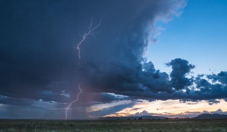
Meteorologists describe the setup as a classic spring pattern: robust upper-level energy colliding with a surface dryline and warm, moist Gulf air. That combination is capable of producing supercells that can generate very large hail, damaging winds and tornadoes. The Weather Channel's regional outlook highlights a multi-day severe threat across the Plains and places parts of Oklahoma inside the corridor of concern through the end of the week. How rough it actually gets will depend on how storms organize late Thursday afternoon into the evening.
Fire risk and a cooler weekend
Western Oklahoma could also see elevated to near-critical fire weather conditions Thursday afternoon and evening, thanks to gusty south-southwest winds and low humidity, as the National Weather Service notes on its site. Once this system moves through, a brief cooldown and drying trend is expected, with KFOR reporting highs near the low 70s on Sunday and overnight lows dipping into the lower 40s Saturday night. That rapid swing means residents may face both severe-storm hazards and heightened fire danger within a short window.
How to prepare
Local meteorologists recommend having multiple ways to receive warnings, including NOAA Weather Radio, local TV alerts and smartphone notifications, and reviewing shelter plans for family, pets and essential supplies. The meteorology team at KOCO has outlined the likely timeline for Thursday's storms and cautions that any cell that becomes supercellular could produce very large hail. Residents are urged to secure loose outdoor items ahead of time and keep phones and backup batteries charged in case power outages accompany the storms.


