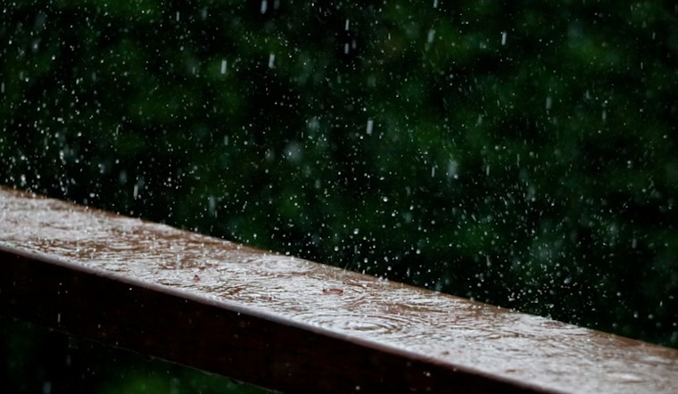
Wednesday, April 29 — Indianapolis is waking up under a steady light rain, mid-50s temps and a gray, splashy start that will linger into late morning. The high should top out near 64°F, with showers backing off later in the day, though a few spotty showers or rumbles of thunder could still pop up. Morning drivers should expect wet pavement and some ponding in the usual trouble spots.
Morning Rain, Watch for Puddles
The wettest window runs through about 11 a.m., with rain chances early today hovering around 90% and new rainfall totals in heavier bands expected to land between roughly 0.5 and 0.75 inches. The steadier rain is expected to break up into more isolated showers by midday as northwest flow takes over. For the freshest forecast details and any advisories, check NWS Indianapolis.
Afternoon Winds Pick Up
By this afternoon, north-northwest winds of 6 to 13 mph should start to flex a bit, with gusts nudging into the low 20s. It will not be a damaging wind event, but it will be enough to make bridge crossings, bike rides and umbrella duty feel extra blustery. Brief downpours could still reduce visibility at times and leave roads slick, so a little extra following distance would not hurt.
Where Flooding Is Most Likely
Minor flooding remains the main concern in low-lying and flood-prone spots south of I-70, where several rounds of heavy rain earlier this week have already left soils saturated. The latest forecast discussion notes that several inches have fallen in some locations, so adding another half-inch to three quarters of an inch could kick off runoff and localized flooding. Obey road-closed signs and steer clear of standing water. Read more in the National Weather Service forecast discussion.
Looking Ahead
Clouds should break up tonight with lows near 41°F, and a cooler pattern hangs on through the weekend with highs mostly in the upper 50s to low 60s. Outlying areas could see a bit of patchy frost Saturday morning. A slow warm-up returns early next week, along with spotty chances for showers and thunderstorms on Monday and Tuesday. For more on how this recent storm train set up over the city, check out how spring sizzle is next.


