St. Louis officials and emergency planners are putting residents on notice as storms roll through with heavier, more frequent downpours. The message is simple and a little urgent: know your flood zone before the next big soaker hits. After a string of intense rains that sent water into streets and basements around the metro, authorities say understanding where water tends to collect can shape how residents prepare and how quickly they can react.
The Metropolitan St. Louis Sewer District's Project Clear runs an interactive "Know Your Zone" flood map that lets people plug in an address and see FEMA flood-zone categories along with a color key for high, moderate and low risk, according to MSD Project Clear. The site also directs users to FEMA's mapping service and preparedness information, and it recommends straightforward steps like raising valuables off the floor and creating a photo record of belongings for insurance purposes. Nobody wants to be scrolling through old selfies trying to prove they owned a couch.
Local TV has been helping to spread the word. KSDK reported that experts are seeing more frequent intense storms, including last April's record rainfall, and that the map gives residents a quick read on their exposure before the skies open up. Broadcasters and stormwater officials have been urging viewers to find out their risk now instead of during a middle-of-the-night flood.
In April 2025, St. Louis logged its wettest April on record, more than 10 inches of rain, topping a mark that had stood since 1893, as reported by St. Louis Public Radio. Scientists say that pattern lines up with broader trends of heavier precipitation across the Midwest, which in turn increases the odds of urban flooding and sudden flash floods.
How to check your zone and what it means
The mapping tool is designed to be straightforward: enter your street address, zoom in, and use the legend to see if your property sits in an A or AE zone, which indicates higher risk, or in a B, C or X zone, which indicates moderate or lower risk, along with any other designations. Details on flood insurance rules and what each zone actually means are laid out on FEMA's FloodSmart site. FEMA's FloodSmart notes that many flood insurance claims come from areas labeled low or moderate risk, and that coverage can be crucial for rebuilding after a serious storm. MSD also provides links to the FEMA Flood Map Service Center for official Flood Insurance Rate Maps and to Ready.gov for step by step preparedness checklists.
Recent storm signals
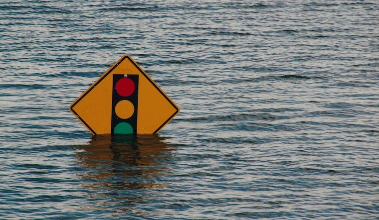
Last Thursday, the National Weather Service issued flash flood warnings for parts of the region after thunderstorms dumped several inches of rain in short bursts, a reminder of how fast city streets and underpasses can turn treacherous. The bulletin repeated the familiar warning, Turn Around, Don't Drown, and cautioned that small creeks, highways and other low-lying spots were at particular risk. Specific locations and timing were detailed in the National Weather Service bulletin.
What officials recommend
Officials are encouraging residents to run their address through the Know Your Zone tool now, sign up for local emergency alerts, and shift irreplaceable items to higher shelves or upper floors before storms move in. They advise keeping a basic emergency kit on hand, storing digital copies of key documents, and looking into flood insurance if the map suggests elevated risk. Drivers are urged to steer clear of standing water, and residents are asked to report localized flooding to city services so crews can respond more quickly.
For fast access to mapping tools and local guidance, MSD's Project Clear site and FEMA's FloodSmart pages offer the core resources and checklists residents need. Local coverage from outlets such as KSDK continues to share the latest advisories and direct links to the map for neighborhoods across the metro area.


