Clouds are hanging over Oklahoma City this morning with temperatures stuck in the upper 60s. By Wednesday afternoon, showers and thunderstorms are expected to become likely, with a high near 81°F and gusty south-southwest winds pushing through into the evening. Some storms could bring brief heavy downpours and strong gusts that may slow tonight’s commute, so keep an umbrella handy and leave a little early if you can.
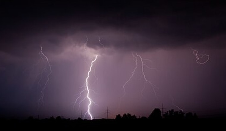
Afternoon Storms Likely
There is a chance of rain showers before 1 p.m., then showers and thunderstorms are likely through the afternoon and early evening, with about a 70% chance of precipitation. New rainfall amounts are generally expected between a tenth and a quarter of an inch. South-southwest winds around 15 to 17 mph are forecast, with gusts as high as roughly 25 to 30 mph in stronger cells.
These storms could bring brief pockets of heavy rain and damaging gusts in the strongest cells, so watch for short-term flooding in low-lying spots. This outlook comes from the National Weather Service in Norman.
Evening Commute And Timing
Showers and thunderstorms are most likely from mid-afternoon into the evening, and some activity may linger past sunset and into the overnight hours. Expect wet roads and slower traffic during the evening rush, since heavier downpours can make short stretches of roadway briefly impassable.
We warned yesterday about gusty winds and late-day storms in yesterday’s storm alert, and today’s update backs up that same timing. Keep weather alerts turned on and avoid driving through standing water.
Thursday Heat And Fire Risk
Thursday should trend sunnier and much hotter, with highs near 87°F across the metro and hotter out west. South-southwest winds will help push humidity down into the 10 to 15% range over western Oklahoma, creating elevated to near-critical fire weather conditions in parts of the western third of the state.
If you live or work west of the metro, avoid open burning and skip spark-producing outdoor chores until humidity recovers. Check local fire-department updates if you are planning outdoor work.
Friday Severe Risk
Another storm system could increase severe risk Friday, especially over western and northwestern Oklahoma. Any storms that form may produce very large hail, damaging straight-line winds and a few tornadoes in isolated spots. If you have outdoor plans for Friday afternoon or evening, have a safe shelter in mind and monitor forecasts through the day.
A cooler, drier weekend is expected after the front passes, with highs in the 60s.
Bottom line: expect an unstable afternoon with gusty south winds and a wet evening commute. Secure loose outdoor items, keep phone alerts on, and give yourself extra time on the roads tonight.


.jpg)