Morning drivers in Oklahoma City are stepping into a warm, windy setup, with mostly cloudy skies, breezy conditions and temperatures starting out in the upper 60s. Strong south winds are expected to nudge afternoon highs into the low 80s before a cold front sweeps through on Friday, April 3, 2026, setting off scattered storms that could ramp up later in the day. Gusty conditions are likely into the afternoon, followed by a quick temperature drop once the storms roll through, so keep afternoon plans flexible, especially around the commute and early evening.
Afternoon Into Tonight
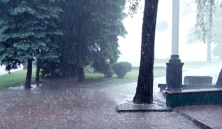
Scattered showers and a few thunderstorms are possible this afternoon, with the threat of stronger storms increasing by mid-to-late afternoon and into the evening. Forecasters say some storms could pack damaging wind gusts and large hail. Early rounds may only drop a few tenths of an inch of rain, while a late-night or overnight batch could bring heavier totals.
Some spots could see around three quarters of an inch to an inch of rain tonight, and localized flash flooding is possible where storms slow down or repeatedly track over the same areas, according to NWS Norman.
Events And Commute
If you are heading downtown for evening events, plan on the possibility of heavy rain and gusty wind during both arrival and departure. Build in extra travel time and think about covered parking or using public transit to avoid a soggy sprint to the door.
The Journey concert at Paycom Center is scheduled for 7:30 p.m. on Friday, April 3, 2026. The venue lists the show and start time on its site, so concertgoers may want to arrive early and keep an eye on venue updates and any traffic advisories before heading out.
Saturday Cooler And Drier
Rain should wind down from northwest to southeast Saturday morning as the cooler, drier air settles in for the weekend. Highs on Saturday, April 4, 2026, will top out in the mid 60s, with overnight lows dipping into the low 40s. A few spots north of the metro could even see some patchy frost. Breezy northerly winds on Saturday are expected to relax as the weekend goes on. For full forecast details, see NWS Norman.
Plan Ahead
Tie down or bring in patio furniture, secure loose outdoor items and keep your phone charged so you can receive local weather alerts. If you are driving through the rain, slow down in heavy downpours and never try to cross a flooded roadway - turn around, do not drown. If a warning is issued for your area, move to an interior room on the lowest floor, stay away from windows and remain there until the storm has passed.


