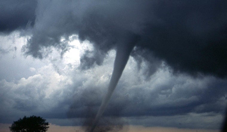
A tornado warning swept across parts of southeast Wisconsin on Tuesday, April 14, 2026, as a fast-moving line of storms barreled east over Waukesha County and nearby communities. The Waukesha Police Department sounded the alarm on social media, noting that the warning window ran from about 8:18 p.m. to roughly 9:00 p.m. CDT and urging everyone in the path to head for shelter immediately. Residents across multiple towns reported outdoor sirens and blaring phone alerts as the storms rolled through.
What the NWS bulletin said
The National Weather Service office in Milwaukee/Sullivan issued the tornado warning based on radar-indicated rotation, laying out a detailed path across parts of southern Waukesha, Racine and southeastern Jefferson counties. Communities listed in the warning included Mukwonago, East Troy, New Berlin, Muskego, Brookfield, Elm Grove and Wind Lake, along with estimated times when each area could be impacted. The bulletin warned that “flying debris will be dangerous to those caught without shelter” and that mobile homes could be damaged or destroyed. Those details appear in the official tornado products from the National Weather Service Milwaukee/Sullivan.
Local response and alerts
The Waukesha Police Department pushed out its warning on Facebook at about 8:19 p.m. CDT on April 14, urging residents to move immediately to a basement or an interior room on the lowest floor of a sturdy building, as the Waukesha Police Department wrote. The post referenced local parks and landmarks inside the warning polygon and reminded drivers to steer clear of flooded or debris-covered roads. Neighbors, local groups and community pages quickly picked up and shared the alert as the storms pushed east.
A stormy night across the region
The tornado warning was only one piece of a busy severe weather evening for southeast Wisconsin. Earlier, the region had already cycled through severe thunderstorm warnings and a broader Tornado Watch. Reports earlier that night described storms marching east at roughly 50 mph as the line organized, and warnings stretched from western counties into the Milwaukee metro area. WTMJ reported on those severe thunderstorm warnings and the wider watch that set the stage for the later tornado alert.
How to stay safe
The National Weather Service did not mince words in its safety guidance, instructing residents to “TAKE COVER NOW! Move to a basement or an interior room on the lowest floor of a sturdy building. Avoid windows,” according to the National Weather Service Milwaukee/Sullivan. The bulletin warned that flying debris could be deadly and stressed that mobile homes are especially vulnerable, urging residents to shelter in the sturdiest part of their home and stay locked in to official updates from local emergency managers.


