Houston woke up under a low, soup-thick fog on Wednesday morning, April 22, 2026, with visibility down to roughly three miles at the KHOU observation and temperatures parked in the low to mid 60s. The dense mist and near-saturated humidity are making roads and sidewalks slick and could slow the early commute in coastal and bay-adjacent neighborhoods.
What To Expect Today
A Dense Fog Advisory is in effect through 9:00 a.m. CDT, after which scattered showers and thunderstorms become more likely across the metro by early afternoon. Forecasts show highs near 806F with the best chance for storms between about 1 and 3 p.m. Most neighborhoods can expect roughly a half to three-quarters of an inch of rain, with isolated heavier downpours possible. For the latest details and the full advisory text, see NWS Houston/Galveston.
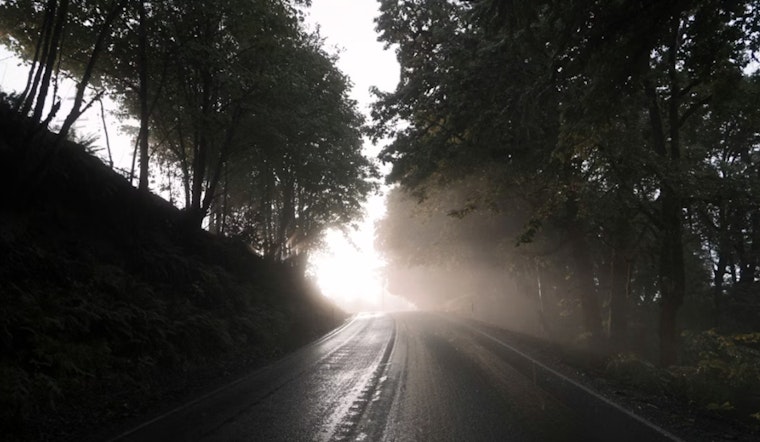
Fog And The Morning Commute
Visibility will be worst near Galveston Bay and on high bridges, so the early drive could be a white-knuckle one in spots. If you have to be on the road before 9 a.m., use low-beam headlights, ease off the gas, and leave extra stopping distance. Expect slower travel times on major corridors, and check real-time traffic cameras before you head out at Houston TranStar.
Afternoon Storms Could Bring Local Flooding
Scattered afternoon storms will be capable of brief but heavy downpours. The stronger cells could drop enough rain quickly to cause localized street ponding in low-lying and poorly drained neighborhoods. Avoid driving through standing water and keep an eye on changing radar as the storms bubble up.
Boaters And Beachgoers
On the water, early-morning fog will cut visibility and winds may pick up at times, so small-craft operators should think carefully about whether today is the day to head out. Forecasters also note slightly above-normal water levels at high tide this week, which can make coastal roads and low-lying beachfronts more prone to flooding.
Looking Ahead
Conditions should quiet down after tonight, with a general warming trend on tap. Expect mid and upper 80s by the end of the work week and lows in the low 70s overnight. For context on a previous fog-and-rain setup that snarled local roads, see our March coverage of thick fog and street-slicking showers.


