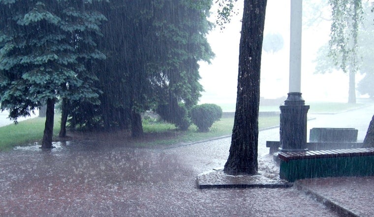
New Orleans is starting Thursday, April 30, 2026, on a muggy note. As of 5:35 a.m. CDT, skies are mostly clear, temperatures sit near 73°F, and humidity is hovering close to 90 percent. That calm start will not last. Scattered showers and thunderstorms are expected to bubble up through the afternoon and grow more widespread by evening, with intermittent heavy downpours that could slow the ride home and leave water pooled on low-lying streets.
This Afternoon And Evening
Showers and thunderstorms are expected to ramp up this afternoon, with the best window for storms between about 3 and 6 p.m. Forecasters with the National Weather Service say storms are likely by late afternoon and could bring quick bursts of heavy rain and street ponding. Most neighborhoods should see a few tenths of an inch of rain, although some pockets could get briefly soaked by heavier cells. Highs will top out near 82°F before sliding back into the upper 70s overnight.
Friday Night And Weekend
Rain coverage increases Friday night, May 1, 2026, with a marginal-to-slight risk for heavier rainfall and localized flooding, with the greatest concern currently north of I-10, toward Baton Rouge and into southwest Mississippi. Thunderstorms, a few of which could be strong to severe, may linger into Saturday while northerly winds pull in noticeably cooler air and gust to around 25 to 30 mph at times. By the time this system moves out Saturday, many locations can expect 1 to 3 inches of rain, with isolated higher totals where storms repeatedly track over the same spots.
Impacts And Tips
Drivers should expect soggy commutes, standing water on low-lying streets, and occasional slowdowns. Avoid driving through flooded underpasses and give yourself extra time to get around. The city’s Ready for Rain resources include neighborhood tools for reporting flooding and getting prepared, along with the Streetwise map and emergency alert signups, all available at Ready for Rain. If you have outdoor plans Friday night or Saturday, it is a good idea to move them inside or pick a different day, especially for waterfront outings and small-boat trips.
Behind the front, temperatures will drop off, with a low near 58°F Friday night and highs only reaching the upper 60s on Saturday. Sunshine is expected to return Sunday, May 3, 2026, with a milder high near 73°F. Keep an umbrella close and a backup plan ready for fast-hitting storms over the next several days, and look for updates if any watches or warnings are issued.


