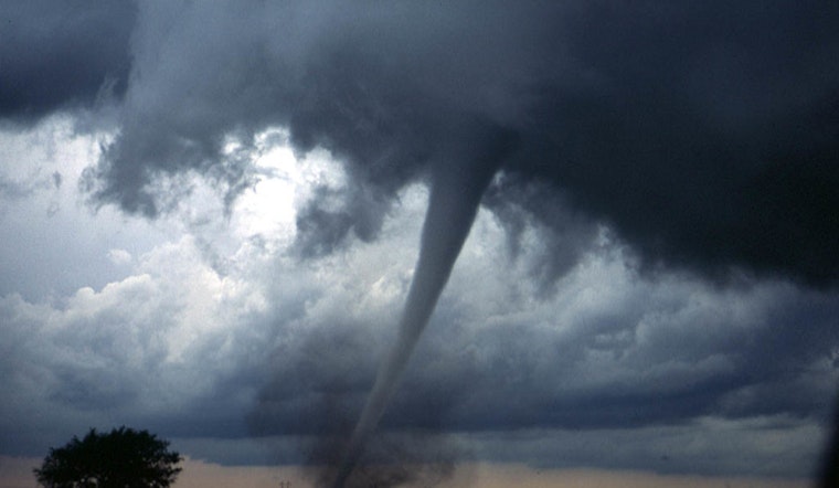
A large slice of northern Oklahoma is under a tornado watch Friday, with the clock ticking until 9 p.m. as storms bubble up in a volatile atmosphere. Forecasters say conditions are ripe for supercell thunderstorms capable of spinning up tornadoes, dropping very large hail and kicking out damaging straight-line winds. People from Enid and Woodward east toward Pawnee and Washington are being urged to wrap up any last-minute preparations and keep a close eye on local alerts.
The NWS Storm Prediction Center has issued Tornado Watch 130 for northern and west-central Oklahoma, in effect from 1:35 p.m. to 9:00 p.m. CDT Friday, according to the Storm Prediction Center. The watch bulletin warns of "a few tornadoes likely with a couple intense tornadoes possible," along with widespread damaging winds and isolated hail that could reach up to 4 inches in diameter. The watch area covers a corridor roughly 80 statute miles east and west of a line from 45 miles north-northwest of Chillicothe, Missouri, to 25 miles south of Enid, Oklahoma.
Local reporting lists the 22 counties included in the watch as Alfalfa, Beckham, Blaine, Custer, Dewey, Ellis, Garfield, Grant, Kay, Kingfisher, Logan, Major, Noble, Nowata, Osage, Pawnee, Payne, Roger Mills, Washington, Washita, Woods and Woodward, and notes that the watch remains in effect until 9 p.m. Friday, per KOKH / OKC FOX. The station points out that many of the communities inside the watch polygon are rural, so residents are being reminded to rely on NOAA Weather Radio and local emergency channels for timely updates.
How To Stay Ready
A Tornado Watch means conditions are favorable for tornadoes and that you should be ready to take shelter quickly if a warning is issued, according to the National Weather Service. The agency advises identifying your safe room or storm shelter ahead of time, keeping phones charged and monitoring NOAA Weather Radio or local alerts for warnings. If a Tornado Warning is issued, you should move immediately to the lowest level of your home or a designated shelter and stay away from windows.
Why Forecasters Are Worried
Forecasters highlighted this setup earlier in Mesoscale Discussion 474, which described very strong instability and wind shear and put the odds of a watch at "95 percent," according to the Storm Prediction Center. That discussion estimated the most probable peak tornado intensity in the strongest storms could reach 100 to 130 mph, raising concern for small towns and farmsteads scattered across northern Oklahoma.


