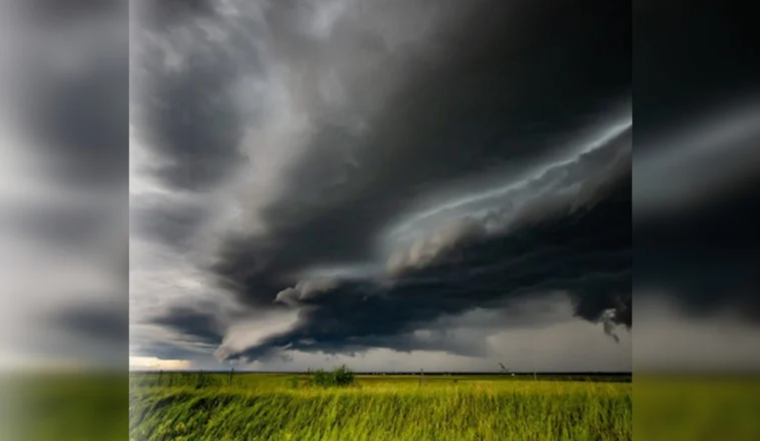
Memphis rolled into Thursday under muggy, mostly clear skies, with temperatures at the airport starting in the low 70s and climbing toward an expected high near 84°F. The calm will not last long. Showers and thunderstorms are likely to fire up through the afternoon and early evening, bringing spotty downpours between about 1 and 5 p.m. Most storms should be brief, single‑cell pop‑ups, but a few could dump heavy rain in a hurry and cut visibility on area roads. If you have outdoor plans or an afternoon commute, it would not hurt to build in a little extra time.
Afternoon Storm Window
Forecasters are zeroing in on the usual trouble zone: peak daytime heating. The best bet for those pop‑up storms runs from midday through the 4 to 6 p.m. drive home. The official call is for a high near 84°F and about a 60% chance of precipitation this afternoon, with light east winds around 0 to 5 mph under mostly cloudy skies as storms bubble up. For an hour‑by‑hour breakdown, check the NWS.
Heavy Downpours And Fog Risk
While coverage will be scattered, the Memphis forecast discussion notes that any one storm can wring out a lot of water fast. Pockets of an inch or more of rain are possible where storms repeatedly pass over the same neighborhood. Forecasters also flag about a 30% chance of dense fog overnight into Thursday morning, especially east of the Mississippi River, which could tangle the early commute and reduce visibility in low‑lying spots. Tonight and Friday could bring higher rainfall totals overall, with some locations seeing a few tenths to a half‑inch or more under stronger cells. For more context straight from the forecasters, read the latest discussion from the NWS.
Weekend Outlook And Tips
The unsettled pattern is expected to hang around through the weekend, with daily chances for scattered afternoon storms and highs in the mid‑80s. A shift to drier, sunnier weather is projected by midweek next week, with highs easing back into the low‑80s. If you are trying to salvage outdoor plans, morning hours look like your safer bet, and keeping an eye on radar later in the day will help you dodge the faster‑moving downpours. You can track current conditions and real‑time radar with the NWS.


