After a parched start to May in central Minnesota, the weather pattern is about to flip. A surge of storms is lining up to drench the region this weekend, with forecasters eyeing Sunday as the main trouble spot for strong, potentially damaging thunderstorms. St. Cloud has logged only a trace of rain so far this month, leaving soils and streams drier than usual even as a sizable system marches in from the Plains. The catch is classic springtime Minnesota: the same rain that could ease drought stress might also bring hail, damaging winds and pockets of flash flooding where storms repeatedly track over the same areas or intensify.
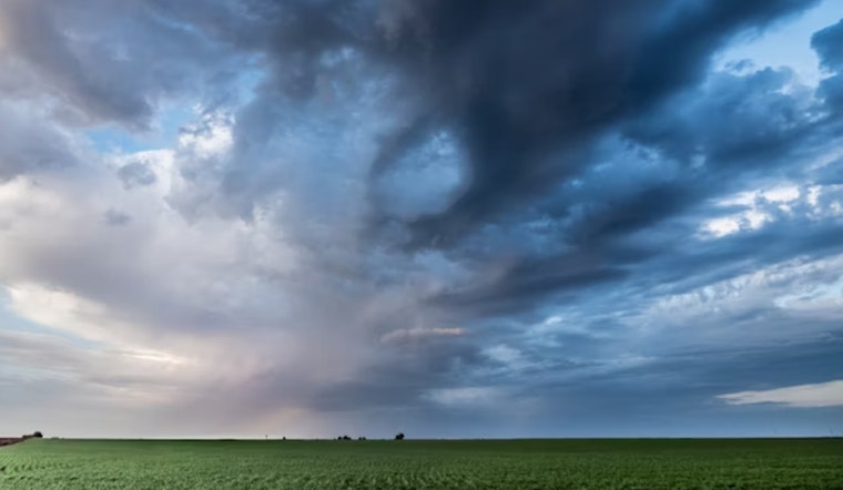
Storms On The Way
According to WJON, showers and thunderstorms are expected to return Saturday night and stick around into early next week. The National Weather Service has tagged Sunday as the day with the greatest potential for strong to severe storms. National outlets are flagging a broad corridor from the Plains into the Midwest for possible severe weather this weekend, and Weather.com notes that damaging winds, large hail and even a few isolated tornadoes are on the table if storms can organize.
Dry Start, A Chance For Relief
Rain would be arriving to a thirsty landscape. The National Weather Service's St. Cloud climate reports show just 0.02 inches of precipitation so far in May, along with a seasonal deficit of roughly an inch since March 1, according to NWS Twin Cities climate summaries. That shortfall shows up on regional drought maps, too. The U.S. Drought Monitor and state-level pages highlight abnormally dry conditions and pockets of moderate drought scattered across Minnesota, per Drought.gov. A good soaking this weekend would help recharge soil moisture, although fast runoff from torrential downpours can still cause local flooding instead of long-term recovery.
Timing And The Main Hazards
The Climate Prediction Center's 6 to 10 day outlook leans toward above-normal precipitation in the May 19 to 23 window, hinting that this weekend's system might kick off a wetter stretch, according to the CPC. Severe weather experts at the Storm Prediction Center and local National Weather Service offices are watching to see whether daytime heating and a sharp frontal boundary can line up on Sunday to spark organized, potentially damaging storms. As the setup comes into better focus, residents are urged to keep an eye on updated convective outlooks and local forecasts for more precise timing and intensity details.
What To Do Now
Now is the time to check your severe weather game plan. Make sure you have a reliable way to receive warnings on your phone and that everyone in your household knows where to go if a severe thunderstorm or tornado warning is issued. For official watches, warnings and radar, head to weather.gov and your local National Weather Service office pages. Even short-lived storms can produce sudden flash flooding and damaging wind gusts in spots that get hit by the heaviest downpours, so treating each warning as the real deal is the safest bet.


