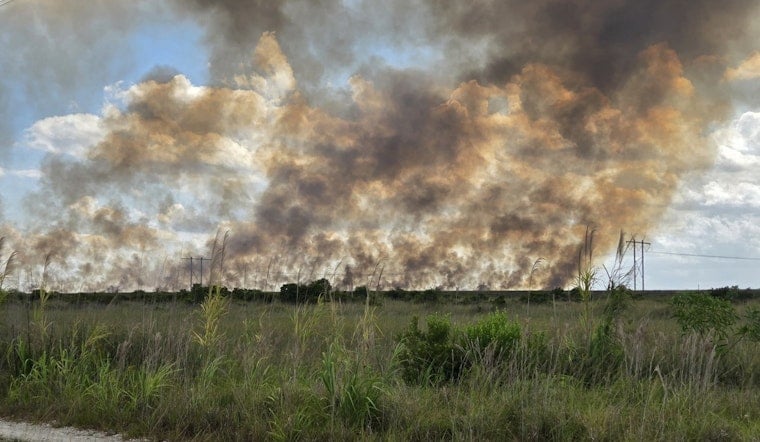
A stubborn wildfire chewing through Everglades marshland west of Miramar had already burned roughly 80 acres by early Sunday afternoon, with firefighters reporting zero containment as they tried to reach the swampy terrain. State crews have labeled the incident the MAX ROAD Fire Miramar, and satellite views showed a clear smoke plume drifting toward neighborhoods in western Broward County.
The Miami office of the National Weather Service shared early satellite shots of the fire on X, noting that GOES-East had picked up flaring activity and a growing smoke plume. NWS Miami flagged the imagery for state and local crews working the incident.
Where the Fire Is Burning
According to a 2:05 p.m. incident update, the MAX ROAD Fire Miramar was estimated at about 80 acres and listed at 0% containment. Florida Forest Service placed the blaze in the Everglades near U.S. 27 and Krome Avenue, close to Mack’s Fish Camp, an area where soggy wetlands make it tougher for ground crews to get in and do direct firefighting.
Satellite Imagery and Smoke
GOES-East rapid-scan sensors are tuned to pick up heat signatures and moving smoke, giving forecasters an early heads-up on flare-ups that can outrun crews on the ground. The satellite data used in that kind of analysis comes from NOAA's GOES-R program, which provided the imagery NWS Miami used to call out smoke pushing over western Broward. NOAA GOES-R
Potential Impacts and Response
Initial reports did not list any evacuations or injuries, but officials warned that smoke could cut visibility on nearby roads and worsen air quality if the plume grows. The Florida Forest Service and local partners were coordinating access and suppression efforts, and residents with respiratory issues were urged to keep an eye on local alerts. Florida Forest Service
This story will be updated as agencies release new information on containment, acreage, or road impacts. For now, NWS Miami and local response agencies remain the primary sources for these early details.


