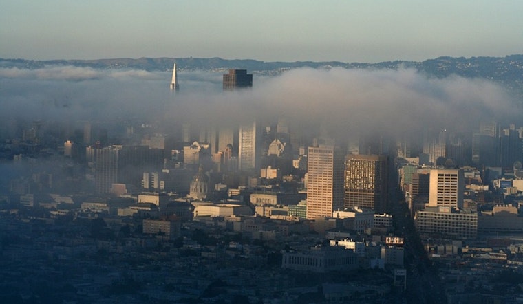
San Francisco woke up today under a blanket of cool, low clouds and patchy fog, with temps stuck in the mid-50s and an afternoon high expected to top out near 68°F. The gray is set to thin into mostly sunny skies by later in the day, right about when those breezy west winds start to kick up around the city.
Afternoon Winds Pick Up
This afternoon, west winds are forecast to strengthen to around 8 to 15 mph across most neighborhoods, with gusts up to 24 mph. The usual exposed hilltops and the immediate coastline could see even stronger bursts. Out over the water, it gets really lively, with coastal gusts potentially reaching 25 to 45 mph. According to the National Weather Service, temperatures may slip a few degrees late in the day as the marine layer muscles back in.
Boaters Should Take Caution
Small craft advisories are posted for Monterey Bay and much of the coastal waters tomorrow, with wind-driven seas building to 10 to 12 feet today and tomorrow and climbing to about 12 to 17 feet later in the week. Small boat owners are being urged to delay trips or hug sheltered harbors until things calm down, and ferry riders should brace for some bumpy, spray-filled crossings. Mariners and beachgoers alike are advised to give the surf zone extra space while seas are running high.
Looking Ahead
A drier, warmer pattern is lined up for tomorrow into the weekend, with highs nudging into the low 70s along the bayshore and interior areas warming into the 80s early next week. Forecasts have next Monday near 80°F and next Tuesday close to 83°F.
What This Means For Your Plans
If you are heading outside, dress in layers for a cool, cloudy morning that turns into a sunnier but breezy afternoon, and tie down or bring in any loose patio gear before the gustiest hours arrive. Anyone planning to boat or hop a ferry should check operator advisories and the marine forecast before leaving shore.


