State transportation officials are taking a hard look at some of St. Cloud's riskiest spots on Highway 10, even if the bulldozers are still a long way off. MnDOT staff told St. Cloud city leaders Monday that two parallel studies of the corridor are honing in on key problem intersections inside city limits, especially 15th Avenue Southeast and East St. Germain Street. Council members saw crash numbers and traffic counts that MnDOT says back up a closer look at grade separations and access-management changes, while hearing a reminder that engineering, design, and construction on state highways roll out in phases and that substantial work can take many years to materialize.
At the meeting, MnDOT District 3 Principal Planner Tom Cruickshank called out the signalized intersections at 15th Avenue SE and East St. Germain as having crash rates higher than the statewide average, and said East St. Germain has logged multiple serious-injury crashes and "three or four" fatal crashes over the past decade, including fatalities involving people walking and biking, according to KNSI. He also told the council that on peak summer weekends, more than 40,000 vehicles can pour through St. Cloud on a stretch of highway that was originally built in the 1960s for significantly lighter traffic volumes.
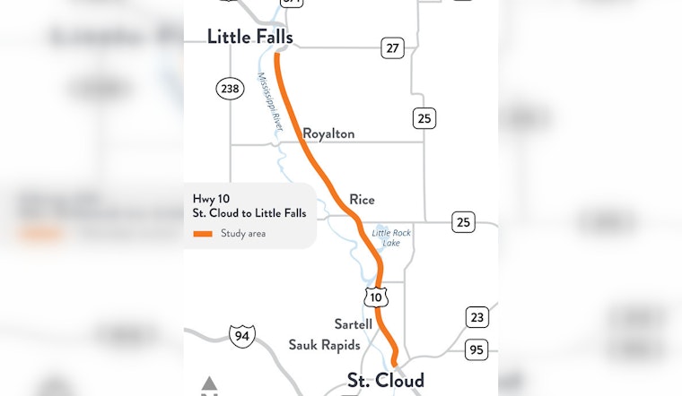
What the 30-mile corridor study is digging into
One of the active efforts is a corridor study that covers roughly 30 miles of Highway 10, from the Highway 23 interchange east to Little Falls, and is meant to pinpoint safety and access needs along that run, MnDOT says. The study is reviewing future land use plans, projected traffic volumes, maintenance needs, and safety data to build phased, implementable recommendations aimed at boosting safety and improving travel reliability over time.
Local planning context
Regional planners and MnDOT engineers say Highway 10's pain points are not exactly breaking news. Frequent at-grade crossings, left-turn conflicts, and signal-related backups were all highlighted in an earlier corridor analysis and remain central concerns in the current round of reviews, according to the Saint Cloud Area Planning Organization's corridor study documents. The APO has been working with MnDOT and local governments as the process shifts from big-picture study work into more detailed engineering.
Options at 15th Avenue and what they mean
For the 15th Avenue SE area, MnDOT's preliminary engineering review is weighing three broad alternatives: keep things mostly as they are and leave intersections at grade, build a bridge over Highway 10, or construct a full grade-separated interchange with ramps. Each path carries very different price tags, right-of-way footprints, and impacts on neighborhood access, according to MnDOT. Officials stressed that project development and design move in stages and can take several years before any construction starts, so any major rebuild would likely be many years, possibly up to a decade, down the road.
What residents can expect next
MnDOT plans to bring more detailed drawings and refined alternatives to the public later this summer, with additional community meetings set up so residents can react and weigh in. Agency staff told the council that decisions on whether to advance specific projects are expected later this year or in early 2027, as reported by KNSI. Drivers, cyclists, and pedestrians who rely on the corridor are being urged to keep an eye on MnDOT's project webpages and local planning notices for display boards, meeting dates, and chances to comment as the alternatives are narrowed down.


