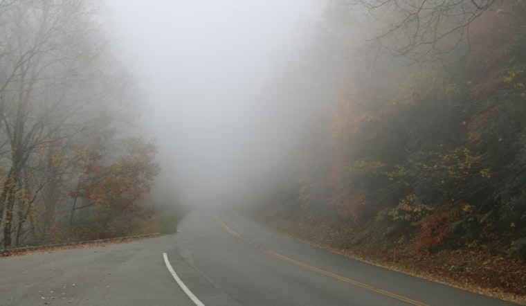
Drivers around Raleigh and the wider Triangle are creeping through patchy, locally dense fog on this Tuesday morning, with temperatures stuck in the mid‑40s. The lowest visibility is popping up in typical trouble spots like low‑lying areas and parts of the northern Piedmont, so the usual advice applies: build in extra time and give the car ahead of you a little more room. The good news is the gloom will not last long, with fog expected to burn off by mid‑morning and skies turning mostly sunny as highs climb toward 74°F.
Fog This Morning
Patchy fog is expected mainly between about 7 and 8 a.m. Tuesday, with visibility briefly dropping to a quarter mile or less in parts of the northern Piedmont and Coastal Plain, according to the National Weather Service in Raleigh. The office issued a Special Weather Statement early Tuesday urging motorists to use low‑beam headlights and slow down. Winds are forecast to stay light at 0–3 mph through the afternoon. Once the sun gets a little higher and daytime mixing kicks in, conditions should improve quickly.
Wednesday Night Showers Possible
A front is expected to approach Wednesday evening, bringing showers and thunderstorms likely after 8 p.m. Forecasters put rain chances at roughly 60% and say new rainfall amounts are likely to total around a tenth to a quarter of an inch. Most of Wednesday looks dry and warm, with highs near 79°F, but any storms that tap into stronger winds aloft could deliver a brief gust. If you have outdoor plans Wednesday night, it is worth lining up a backup option or shifting activities earlier in the day.
Weekend Heat Builds
By late week, the pattern shifts to more of a summertime feel. Highs are expected to reach the upper 80s on Saturday, then push into the lower 90s by Sunday and Monday. An afternoon sea‑breeze and a few isolated storms may briefly knock temperatures back in spots, but overall the trend is toward markedly warmer afternoons through early next week. If you will be outside for long stretches, keep sun protection and plenty of water close at hand.
Commute Tips
If you need to be on the road before sunrise, slow down, stick with low beams and leave extra stopping space between you and the next car. Travelers headed to the airport should confirm early flights with their carrier in case the low visibility triggers delays. For context on recent fog in the Triangle, see this look at recent fog in the Triangle. No watches or warnings were in effect from the local forecast office as of early Tuesday morning.


