A cluster of yellow and white buoys nicknamed “Bob” is now bobbing along the Potomac, Anacostia and Shenandoah rivers, quietly streaming near real time water quality readings to a public map. The small, fishing bobber style monitors track temperature, turbidity, salinity and dissolved oxygen, giving paddlers, anglers and researchers minute by minute visibility into what is happening on (and below) the surface. Local officials and river advocates say the continuous record could help spot pollution events faster and give people more confidence when deciding whether to get on the water.
Public dashboard puts river readings on the map
The Reservoir Center for Water Solutions this week launched a public dashboard that plots monitoring sites across all three rivers and lets users see current readings or download raw data, according to the Reservoir Center for Water Solutions. The map displays pH, water temperature, conductivity, dissolved oxygen, phycocyanin and other parameters, and it stores the measurements so experts can track trends over time. A simple color system flags sensor conditions as “good,” “impaired,” “unusual” or “offline,” so users do not need a science degree to get the gist.
Who built Bob and who keeps an eye on him
The floats, designed to look like oversized yellow and white fishing bobbers and nicknamed “Bob,” were donated in part by Xylem Water Solutions and will be monitored and maintained by local watershed organizations, according to WTOP. Local officials quoted in that reporting said being able to report on “a daily basis, an hourly basis, what’s happening in the river makes an enormous difference.” The Bob network layers onto long running monitoring efforts by nonprofit riverkeepers and watershed groups throughout the region.
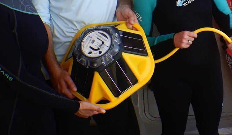
How Bob collects and checks the data
Each station uses a YSI EXO2s sonde that sits either inside the buoy or mounted to a dock. Solar panels power the system, and data rides over cellular networks into the dashboard about every 15 minutes, the project explains on the Reservoir Center for Water Solutions site. Readings are run through automated QARTOD quality control tests, and if a sensor fails those checks the dashboard labels the data point as “unusual,” which is a cue for maintenance. Project documentation also stresses that the public data are informational tools and do not replace official health advisories.
Why Bob’s timing is no accident
The push for always on, public monitoring follows the January collapse of the Potomac Interceptor sewer line, which released hundreds of millions of gallons of untreated wastewater into the Potomac River and triggered regional health advisories, according to the U.S. Environmental Protection Agency and the District’s Department of Energy and Environment. Agencies have since stepped up sampling and oversight, and advocates say an easy to access sensor network can help catch localized spikes and document the river’s recovery while repairs continue. Community groups also see the new, public data stream as a way to bolster accountability on aging infrastructure and long promised cleanup work.
The dashboard is already live for anyone who wants to check conditions before heading out on the water, and authorities are reminding people to report spills or suspicious discharges to federal hotlines such as the National Response Center at 1-800-424-8802, according to NOAA's Office of Response and Restoration. The live readings and downloadable files give scientists, riverkeepers and neighborhood groups a fresh layer of evidence as the region works to restore and protect its rivers.


