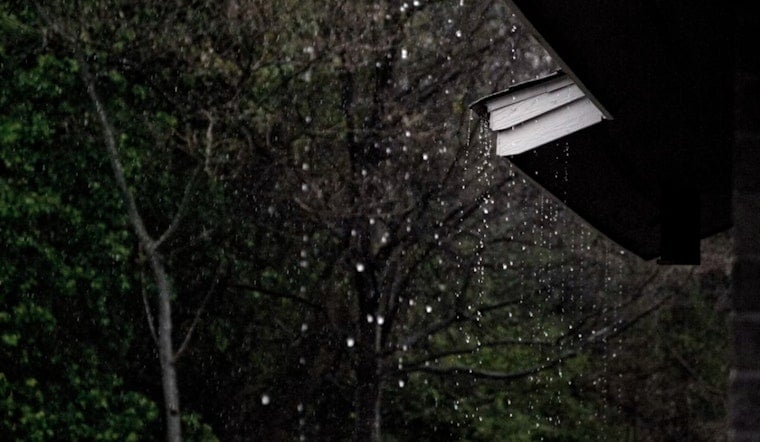
Portland is starting the day on the cool and cloudy side, with temperatures hovering near 55°F at Portland International Airport. Skies should turn partly sunny later, and while there is a slight chance of spotty rain showers this afternoon, the high will still climb to around 67°F. With light south-southwest winds in play, most neighborhoods are more likely to see mist or a quick sprinkle than any kind of steady soaking.
This Afternoon And Tonight
From about noon to 5 p.m., there is a slight chance of rain showers, with the best odds for actual wet weather along the coast, the Coast Range and the Cascades. Interior valleys, including much of the Portland metro, are expected to stay mostly dry. Tonight, the chance for showers ticks up after 11 p.m., with a low near 49°F and west-southwest winds around 5 to 9 mph. Gusts could briefly reach up to 18 mph.
Saturday Storms To Watch
The main event arrives Saturday, June 6, when a stronger trough moves inland and showers and thunderstorms become likely through the midday and afternoon hours. Highs will be close to 62°F, and some storms could deliver brief heavy downpours, small hail and gusty winds up to about 20 mph. If you are planning outdoor events, it is smart to have a quick shelter plan ready, especially between roughly 11 a.m. and 5 p.m., according to NWS Portland.
Winds, Gorge And The Commute
It will be breezier in the Columbia River Gorge and on other exposed ridges, where routine gusts of 25 to 35 mph are likely and a few isolated 40 to 45 mph gusts are possible over the highest terrain. Mariners should keep an eye out for seas building into the 6 to 8 foot range. On the roads, any brief heavy downpours could quickly cut visibility, so leave yourself some extra time if you are driving east toward the Gorge.
Early Next Week
After a comparatively drier Sunday, look for a cooler and wetter stretch from Monday, June 8, through Wednesday, June 10, as another trough slides over the region. The forecast discussion from NWS Portland puts the odds at about 50 to 55 percent that some west-slope Cascade locations pick up an inch or more of rain between 5 a.m. Monday and 5 a.m. Wednesday. By Thursday, June 11, the pattern is expected to trend drier and warmer.
Bottom line: today’s showers should stay light and scattered, but Saturday and early next week are poised to bring the most impactful rounds of rain and wind. Keep an eye on updated forecasts and make sure you have a backup plan ready if your Saturday hinges on outdoor plans.


