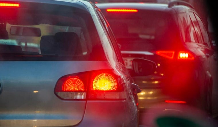
Atlanta drivers burned through the equivalent of more than two workweeks just sitting in traffic last year, about 87 hours per commuter stuck behind the wheel. The daily crawl is not only a side effect of population growth. It is also the product of a city map first carved by railroads, then locked in place by midcentury highway plans that squeeze cars into a tight downtown bottleneck.
According to the Texas A&M Transportation Institute 2025 Urban Mobility Report, metro Atlanta commuters lost about 87 annual person-hours of delay per driver in the most recent data year, putting the region among the most congested very large metros in the country. The institute's tables show that congestion has climbed steadily from the early years of the report into the 2020s. Those lost hours add up to measurable hits in productivity and fuel use across the region.
Channel 2 set out to trace that modern mess back to its roots, and the trail runs straight through the rail yards that created the city in the first place. As reported by WSB-TV, Atlanta started life as "Terminus," a rail town whose streets bent around tracks instead of following a tidy grid. "These roads that emanate from the railroads were built for mules and wagons," Atlanta History Center historian Paul Crater told the station, a not-so-subtle reminder that the city’s bones were never designed for multilane freeway traffic.
How Postwar Highways Froze a Railroad City in Place
After World War II, planners doubled down on that irregular skeleton instead of replacing it. The 1946 Lochner plan sketched a network of expressways that converged into what drivers now know as the Downtown Connector, along with the routes that circle and feed the core. Planning records kept by the Georgia Department of Transportation show that the early blueprint steered limited-access highways through central corridors, often in areas labeled "blighted." Scholars and historians have pointed out that those decisions disproportionately cut through predominantly Black neighborhoods, uprooting residents and leaving long-lasting scars in the city’s fabric.
That pattern picked up speed when Washington started paying for big concrete. The Federal-Aid Highway Act of 1956 supplied the money and political backing for large urban freeways. The Federal Highway Administration details how the interstate era reshaped cities nationwide, and in Atlanta the result was a set of spokes and a perimeter, today’s I-75, I-85, I-20 and I-285, that drew a sharp line between "inside" and "outside." Over time, that structure encouraged outward growth and longer, car-dependent commutes.
Closures, Maintenance and the Daily Grind
Recent repair projects have shown just how fragile that setup can be. When the state temporarily shut down a stretch of I-285 for concrete replacement this spring, coverage in the Atlanta Journal-Constitution found that detours and targeted messaging pushed traffic onto alternate corridors, where heavy, localized backups quickly formed. There is only so much slack in the system when most routes ultimately feed the same chokepoints.
The Texas A&M data also make clear that the brief COVID-era breather did not last. Traffic volumes and delay bounced back quickly, leaving Atlanta with some of its worst congestion in the historical record once commuting patterns resumed.
Big Fixes, Big Price Tags, Few Easy Outs
On paper, there are plenty of big ideas to untangle this. Planners have floated everything from building parks on top of pieces of the Connector to expanding bus and rail service. Turning sketches into concrete, tracks or green space is another story, slowed by eye-watering costs and complicated engineering.
Central Atlanta Progress has been studying one of the most ambitious concepts, a proposed deck park called "The Stitch" that would cover part of the Connector and knit Midtown and downtown back together. Early feasibility work envisions roughly 14 acres of new park space, with preliminary studies putting the cost in the hundreds of millions of dollars.
More modest steps are on the table too. Ideas like rerouting some freight traffic, improving signal timing or making incremental transit upgrades tend to be cheaper, but they bring their own headaches. Each requires coordination across multiple agencies and jurisdictions, and there is no single lever that can instantly fix a century of layered decisions.
For Atlantans, the takeaway is not especially comforting but it is straightforward. Today’s gridlock grows out of choices made over many decades, from the placement of the first rail lines to the routing of freeways and the spread of development that followed. Loosening that grip will demand a mix of major engineering projects, steady funding and sustained policy shifts. As officials juggle routine repairs alongside long-range schemes like The Stitch, commuters can expect occasional major disruptions even while the broader debate continues over whether the ultimate cure is a cap, better transit, or simply fewer cars in the system.


