

























































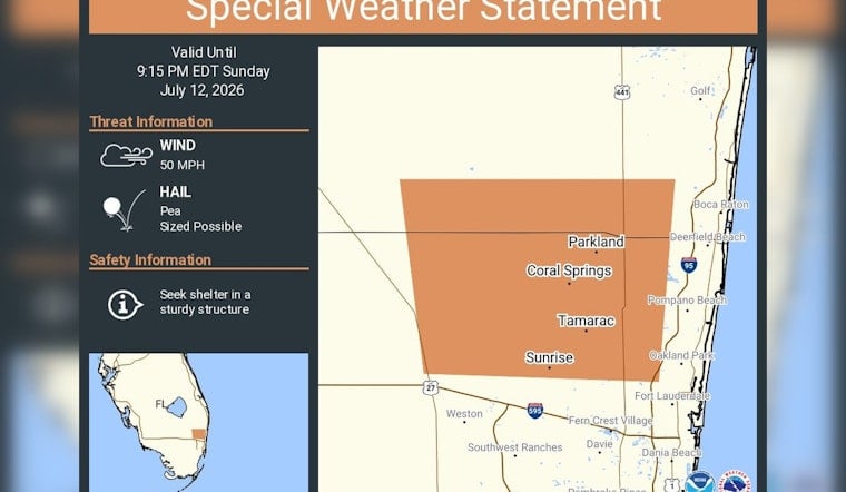
Sunday evening brought a quick burst of storm drama to northwest Broward as the National Weather Service issued a special weather statement for Coral Springs, Sunrise and Tamarac, warning residents to brace for gusty winds and brief hail. The advisory remained in effect until 9:15 p.m. EDT while a line of storms slid east across northern Broward County. Forecasters cautioned that the strongest cells could knock down small limbs and send unsecured outdoor items tumbling across yards.
A special weather statement has been issued for Coral Springs FL, Sunrise FL and Tamarac FL until 9:15 PM EDT https://x.com/i/status/2076464757310099942
— NWS Miami (@NWSMiami) July 12, 2026
Storm Details And Hazards
At 8:32 p.m. EDT, the National Weather Service in Miami flagged a strong thunderstorm about seven miles west of Coral Springs that was moving east and capable of producing “wind gusts of 45 to 50 mph and pea size hail,” listing Fort Lauderdale, Coral Springs, Pompano Beach, Plantation, Sunrise and Tamarac among the locations at risk, according to National Weather Service Miami. The product set the maximum hail size at 0.25 inch and the top wind gust near 50 mph. Forecasters said the hazards were radar-indicated as the cells pushed east across northern Broward County.
Regional Reports And Context
Short but intense summertime storm cells have delivered similar conditions across South Florida this month. NBC 6 South Florida recently shared video of pea-sized hail pelting Miami Gardens in late June, a reminder of how fast a routine shower can flip into something more hazardous. Those brief storm cores can kick up sudden gusts and small hail that nick plants, pummel patio furniture or stress thin roofing materials.
Safety Steps For Residents
If you are in the path of storms like these, officials advise heading inside a sturdy building or a hard-topped vehicle and steering clear of trees, open shelters and bodies of water until the threat moves on. Federal guidance recommends seeking shelter at the first rumble of thunder or flash of lightning and waiting at least 30 minutes after the last clap of thunder before resuming outdoor activities, according to Ready.gov.
Where To Get Updates
For rolling updates while storms are active, follow NWS Miami on X and keep an eye on the office’s page at National Weather Service Miami for new products and radar snapshots. Local emergency management channels and NOAA Weather Radio will also carry advisories as the weather evolves.




