

























































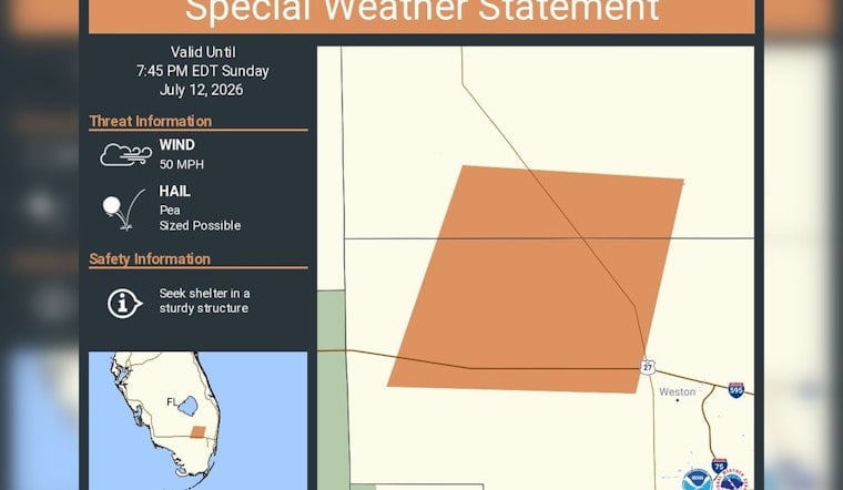
Broward County spent Sunday evening looking warily at the sky, with a special weather statement in effect through 7:45 PM EDT as radar-tracked thunderstorms threatened pockets of pea-sized hail and winds near 50 mph. The advisory zeroed in on western Broward communities, including Weston, as sitting under the strongest storm cores. Officials urged residents to head indoors and tie down anything in the yard that might decide to take flight.
In an alert posted by NWS Miami, forecasters warned that radar-indicated storm cores could kick up pea-sized hail and gusts up to around 50 mph, with the statement staying in place until 7:45 PM EDT. The post also told people to "seek shelter in a sturdy structure" while the storms moved through.
The same guidance runs through the formal special weather statement on the National Weather Service site, which logs a "MAX HAIL SIZE...0.25 IN" and a "MAX WIND GUST...50 MPH" for inland and metro Broward County, according to National Weather Service Miami. The product lists Weston among the locations at risk and notes that the hail and wind threats were radar-indicated.
Storms Can Knock Down Limbs And Damage Property
Winds around 50 mph can snap smaller branches and turn unsecured patio furniture into projectiles, while pea-sized hail is still plenty big enough to leave dings on cars. Recent coverage from NBC 6 showed pebble-size hail pounding Miami Gardens in a June storm that also brought damaging gusts.
How To Stay Safe
Broward County's Emergency Management office recommends that residents sign up for AlertBroward to get official notifications straight to their phones, according to Broward County Emergency Management. People are advised to stay inside, avoid driving through heavy hail, and treat any downed power line as live until utility crews say otherwise.
For real-time radar and updates, keep an eye on local broadcasters such as Local 10 and NBC 6. We will update this post if the National Weather Service upgrades the special weather statement to a warning.





