

























































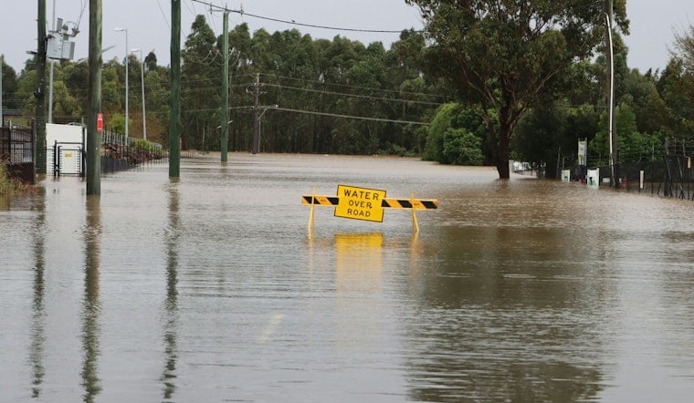
Flash flood warnings rolled across the Midstate on Sunday evening as intense, slow-moving storms dumped heavy rain over pockets of Middle Tennessee and into southern Kentucky. Multiple counties landed under warnings, pushing emergency managers and the National Weather Service into high gear while water rose fast in low-lying neighborhoods and along small creeks.
The Tennessee Emergency Management Authority warned that “Flash flooding is occurring or expected” and reminded drivers to “never drive through flooded roadways,” according to WSMV. The alert, based on National Weather Service guidance, covered parts of Cheatham, Davidson, Rutherford and Williamson counties into the evening. Local officials urged anyone in immediate danger to call 911 and to respect lane closures and detours, even if the detour adds a few extra minutes.
Where the warnings were in effect
The National Weather Service office in Nashville issued flash flood warnings that swept in areas of Cheatham, southwestern and central Davidson, Williamson and nearby counties, cautioning that small streams could rise rapidly and urban flooding was likely, as detailed by NWS Nashville. The bulletin singled out Franklin, Brentwood and Spring Hill as spots where roads and underpasses could flood. Forecasters said radar showed heavy rain with training storms that could quickly overwhelm drainage systems.
Roads, power and travel
Drivers are encouraged to use TDOT's SmartWay site for real-time road closures and to check local utility outage maps, as compiled by WSMV. Severe storms can also snarl air travel, so anyone flying out of Nashville International should confirm flight status through BNA before heading to the airport. And if you roll up on a flooded roadway, the advice from every safety official is the same: turn around, do not try to cross.
How to stay safe
The National Weather Service’s signature flood-safety message, “Turn Around, Don’t Drown,” stresses that just a few inches of moving water can sweep a vehicle away, per the National Weather Service. Officials recommend signing up for city and county emergency alerts, keeping phones charged, and heading to higher ground if water starts to rise. In life-threatening flooding, call 911 immediately and follow directions from local emergency managers.
Forecasters said additional showers and storms could redevelop into Monday, so residents in low-lying or flood-prone areas are urged to stay tuned to updates from NWS Nashville and local emergency officials. This story will be updated if warnings change or if authorities release new impact reports.





