

























































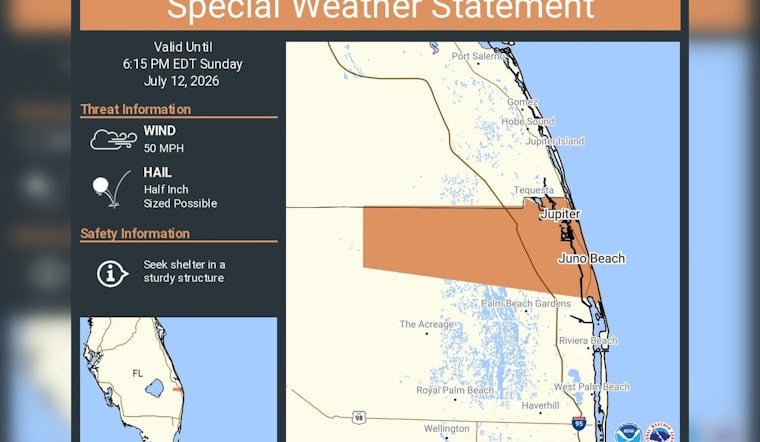
Evening plans along the northern Palm Beach County coastline may be on shaky ground, as the National Weather Service has issued a special weather statement for Jupiter and Juno Beach that remains in effect until 6:15 p.m. EDT. Forecasters say radar‑indicated storm cores could spit out pea‑to‑half‑inch hail and send wind gusts near 50 mph ripping through the area, and they are urging residents to ride things out inside sturdy buildings while the cells pass. The advisory covers portions of the Palm Beach County coastline and could quickly disrupt outdoor activities with sudden heavy rain, frequent lightning, and the risk of downed limbs or brief power outages. Boaters and beachgoers are being warned to brace for conditions to deteriorate in a hurry while the statement is active.
A special weather statement has been issued for Jupiter FL and Juno Beach FL until 6:15 PM EDT https://t.co/Qyg7HHwXIM
— NWS Miami (@NWSMiami) July 12, 2026
NWS Flags Radar‑Spotted Hail And 50 mph Gusts
According to NWS Miami, the special weather statement calls out hail up to 0.5 inch in diameter and radar‑indicated wind gusts near 50 mph over Jupiter and Juno Beach. The post underscores that people should “seek shelter in a sturdy structure” and stay put until the storm cores move through the area.
Sea Breeze Collisions Fuel Quick-Hitting Summer Cells
Short‑lived but intense thunderstorms are a staple of South Florida summers, popping up when sea‑breeze fronts collide and daytime heating builds tall convective cells that can unleash strong straight‑line winds and small hail. A recent forecast discussion from NWS Miami notes this diurnal pattern and highlights how storms often ramp up quickly in the afternoon and early evening, which is why forecasters sometimes follow fresh radar signatures with short‑fuse special statements along the coast.
How To Stay Safe During Fast-Moving Summer Storms
If you are caught outside when one of these cells rolls in, the American Red Cross recommends heading indoors immediately and steering clear of trees, open shelters, and metal structures. If there is a moment to spare, secure loose patio furniture, then stay away from windows during the strongest winds. Do not drive through flooded streets; wait for conditions to improve, and report any downed power lines to local authorities. Keep a phone charged, monitor local emergency channels and NOAA Weather Radio for updates, and follow directions from public-safety officials if the weather starts to go downhill.




